Enoch, Utah

Enoch is the second largest city in Iron County. Located slightly north of Cedar City, Enoch is a widespread rural community that thrives with agriculture. In the early 2000s, the community saw a huge increase in population as well as demands. The residents were more eager than ever to expand local businesses, churches, and neighborhoods to accommodate the basic services. Today, nearly 6,000 people reside in Enoch and it is expected to continue growing.

Not only is Enoch teeming with agriculture, but it is rich in history, too. The area was first stumbled upon in the mid-1800s during one of the most prevalent times in history: the Old Spanish Trail. Being one of the major stopping points for trading and riches, the area was later revisited in 1851 where it was formerly named Johnson’s Ranch. Joel J. Johnson was the first settler in the area but only stayed temporarily due to Indian troubles. Several years later the area was inhabited once again by travelers and reestablished as Johnson’s Fort. The rural area grew for the first time when John Pidding Jones, his family, and others migrated to Johnson’s Fort. In 1956, the then-former Johnson’s Fort was officially settled as Enoch after the Mormon United Order. Small communities began to take root and the agriculture system escalated with growing demands that still stand to this day.

Off-Highway Vehicle (OHV)

Head out toward Three Peaks Recreational Area and cruise over volcanic rock formations and rolling hills. Several times a year 4 x 4 rock crawling competitions are held.

Mountain Biking

Race down one of the many biking trails over large rock formations and through the challenging desert terrain in the Three Peaks Recreational Area.

Horseback Riding

Enjoy a relaxing day of horseback riding and sightseeing as you explore the magnificent red rock wonders of Southern Utah.

Modena, Utah

Still an unincorporated community, Modena is the second most important railroad town located in the far western outskirts of Iron County. On April 30th, 1899, the rails of the Oregon Shortline crossed through Desert Spring just three miles north of Modena. Many railroad crews and soon farmers and miners inhabited the area, setting the stage for residential and economic growth. Stores, hotels, and forwarding warehouses began to line the streets along with a weather observer in 1910. With the advancement in transportation, the diesel train engine, and the start of World War II, railroad workers were able to commute to work from anywhere and eventually left Modena. Many of the businesses and other establishments that once flourished are now shut down and the area is now recognized as an old historic ghost town. Modena is now home to desert dwellers and other residents seeking to escape the urban life.
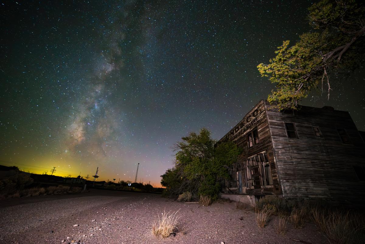
Historic Site

Enjoy a self-guided tour around the historic ghost town and see old saloons, hotels, and railroad sites.

Paragonah, Utah

Nestled at the base of a hill just east of the stream, Red Creek, Paragonah (pronounced locally as pair-a-GOON-ah) is an ideal location for recreation, and the perfect place to head out with a rod and reel for a family fishing outing.

Paragonah was settled by residents from the nearby town of Parowan in the early 1850s who found the meadows next to Red Creek an ideal location for farming. Originally known as Red Creek, Paragonah is a Paiute Indian name believed to mean several things including “red water,” “warm water,” or perhaps “many watering holes.” It was once written and pronounced as “Paragoonah,” but in the late nineteenth century, one “o” was dropped from the spelling (though the pronunciation remained the same).

A large number of mounds and petroglyphs near Paragonah indicate large prehistoric populations of Fremont peoples, and the legacy of Paragonah settlers continues to be one of hard work and craftsmanship. Their motto in the nineteenth century was “Paragonah, The Abode of Thrifty Pioneers.” Incorporated as a town in 1916, they had an elementary school until the 1950s, but students now attend school in Parowan. Even with no industry, the number of residents has stayed stable, ranging from 300 to 500 for many years.

Fishing

Paragonah Reservoir, just 8 miles to the east, is a great destination for either a family fishing outing or for the avid fly fisherman. Gorgeous rainbow trout typically range in size up to 17 inches. There is no boat ramp, but small boats can be launched from the shore. Unimproved camping and car accessible (summer & fall only). May is a great time to watch the spawning fish, remember no fishing in spawning areas. *Generally not accessible in the winter.

Yankee Meadow Reservoir: 15 miles southeast, via Hwy 143, turn left at the five-mile marker onto a good gravel road. Stocked annually with rainbow trout, brook trout, and Bonneville cutthroat trout. There are two Forest Service campgrounds in the area; camping is not allowed near the lake. A restroom and gravel launch ramp are available at the lake. There are no garbage facilities at the lake, so please pack out what you pack in. General statewide fishing regulations apply. *Generally not accessible in the winter.

Off-Highway Vehicle (OHV)

Red Creek Canyon Road: take Center Street out of Paragonah (going east). Red Creek Canyon Road is generally a good gravel road that takes you to Red Creek Reservoir. After Red Creek Reservoir it gets a little narrower and in bad weather could become quite a mess. This road eventually connects to the main road to Panguitch Lake, Horse Valley Road. It will take about 2.5 hours to travel the 24 miles to the Lake.

Little Creek Canyon Road: located just north of Paragonah and heads east. On the way up Little Creek Canyon Road you will see quite a few nice rock formations. Little Creek Canyon Road heads north to Hwy 20, or you can continue south to Horse Valley Road and Panguitch Lake.

Horseback Riding

Enjoy a relaxing day of horseback riding and sightseeing as one explores the magnificent red rock wonders of Southern Utah.

Summit, Utah

Summit is situated midway between Parowan and Cedar Valleys and was originally laid out as a herding ground. Located at 5,955 feet, Summit is the highest little town on I-15 in Utah, and with a population of only about 160 people, this sleepy little town is the perfect place for the locals who have stayed and retirees who have moved in to sit back and relax and enjoy the beauty of scenic Southern Utah.

Without the distractions of stores or services, the people of Summit have learned to create their fun. Though horse-drawn sleighs have transformed into four-wheelers pulling inner tubes, and summer sees more mountain bikers and ATV riders than those on horseback, there are still plenty of horses to be found and miles of country to explore.

The history of Summit began as a herding ground in 1853 and in the spring of 1858, Samuel T. Orton and others moved near Summit Creek and began farming. As more families joined them, each farmed small plots and herded sheep.

In July 1877, Summit LDS Ward was organized, and a log schoolhouse was replaced with a one-room concrete building which was replaced by a two-room brick school in 1920 that housed students through the seventh grade. Because of this firm foundation in education, Summit has been able to point with pride to the well-qualified and outstanding professional teachers who originated in this little town.

Scenic Drive

The easiest way to see the beauty of the backcountry is by vehicle. Just be aware that backways can have surfaces that vary from pavement to gravel with varying degrees of travel difficulty. High clearance vehicles are recommended for most dirt roads and many require 4-wheel drive. Conditions can change quickly after storms. Check at a visitor center before driving on unpaved roads. When planning your trip along a backway it’s advisable to bring preparedness items such as food, water, spare tire, and maps. Cell phones often do not work in the backcountry. Always tell someone your travel plans.

Dry Lakes Backway / Summit Mountain Road

Backway provides sweeping views of Parowan Canyon, Sugarloaf Mountain, High Mountain, and Cedar Breaks National Monument. This is also the access road to the Twisted Forest hiking trail and Ashdown Gorge Wilderness Area. The road begins 8 miles up National Scenic Byway SR-143. This is a good gravel road with very steep grade coming off the High Mountain towards Summit township. The road is 19 miles long. Check road conditions ahead of time. Closed in winter.

Off-Highway Vehicle (OHV)

Off-highway vehicles are permitted on designated roads. Cross-country travel is prohibited and OHVs are not permitted on hiking trails. Check at visitor centers for maps and information before riding.

Mountain Biking

Experience the great beauty of scenic Southern Utah on incredible scenic backways including the Summit Mountain Road and Dry Lakes Road.