Outdoor Activities

Add To Bucket List

Go Outside

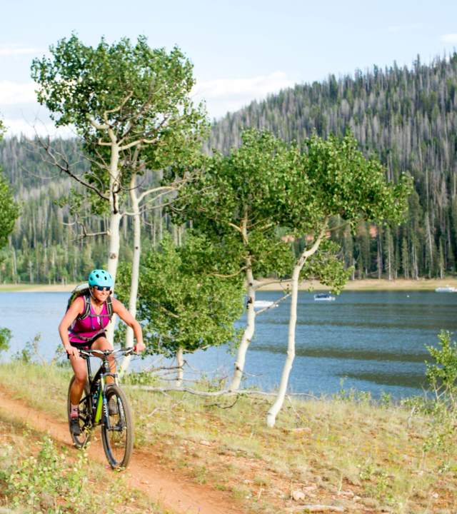
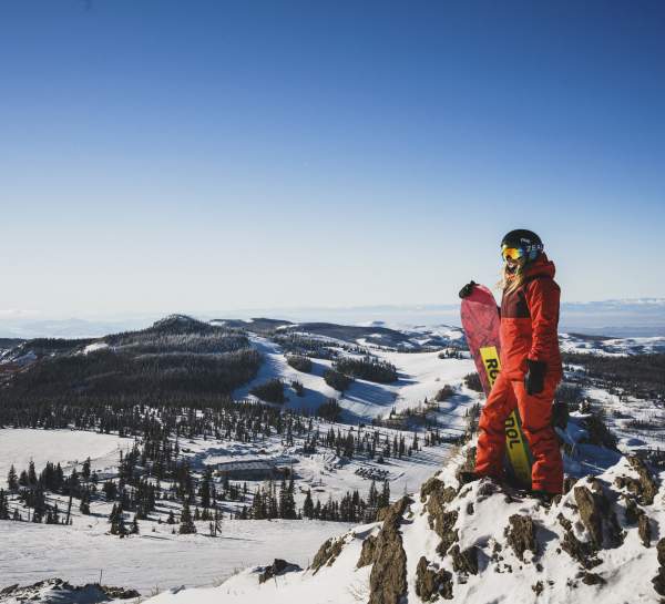
Everyone knows that Utah has the greatest snow on earth, but did they also know that we have the sickest dirt jumps, the cleanest air, some of the richest human history, and the coolest hikes on earth, too? Living life elevated means a never-ending array of snow sports, fishing, hiking, mountain biking, golf, motorsports… the list goes on and on, proving that there really is something for everyone in Cedar City.

It might sound surprising that our little neck of the woods has the incredible powder to shred. But the high elevation and clean atmosphere produce crisp snow that’s perfect for backcountry skiers and snowshoe hikers alike. The dusty dirt trails of the high desert terrain create exciting twists and turns that offroad vehicles thrive on. The steep mountainside climbs challenge any seasoned hiker while the lively rivers feed the crystal blue lakes that house some great fishing game. Then, when you’re camping under the open sky, you’ll be able to see the stars perfectly without any distractions from nearby light pollution. Oh, and did we mention there’s golf?

No matter what your favorite outdoor activity may be, we have more than enough to give you a lifetime of memories.

More than a few things to add to your bucket list.

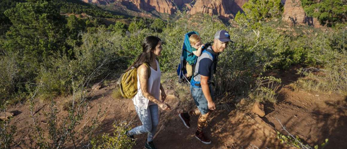
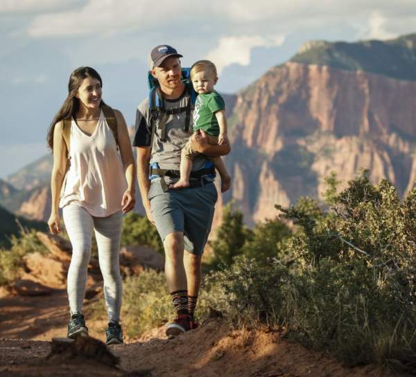
Hiking in Southern Utah is a great way to explore the region and experience the beautiful scenery. You can find everything from arches and waterfalls to ancient forests, narrow canyons, and majestic overlooks. Trails range from easy walks to challenging overnight excursions. Get out there and explore!

Download the Hiking Trails Guide HERE

*NOTE: Some hikes are at high elevations and may not be suitable for individuals with pulmonary problems. Hike at your own risk.

Dog Friendly – Leash Required

  • Brian Head

    There are excellent hiking trails in the mountains around Brian Head with breathtaking views and scenery that everyone can enjoy.

    Brian Head Town Trail 9,500 ft.

    EASY | 2 MILES | SUMMER-FALL | POINT TO POINT

    This paved trail follows Highway 143 through the forest and wildflower meadows of Brian Head. Trailhead at several points throughout town including Brian Head Resort and Georg’s Ski Shop.

    Manzanita

    EASY | 2.5 MILES | SUMMER-FALL | LOOP

    Trail traverses along manzanita covered hillside through spruce and aspen stands to provide beautiful vistas of Brian Head and Parowan Canyon. Trail loops back around on dirt county roads. Trailhead from Hwy 143 at the North end of Brian Head, head West on Aspen Drive to Sandstone Road (first right). Turn North on Sandstone and continue to the trailhead.

    Download a Manzanita Trail Map HERE

    Navajo Loop

    MODERATE | 3.5 MILES | SUMMER-FALL | LOOP

    Meanders through the hills on the West side of Brian Head, traversing through spruce and aspen groves and mountain meadows. Vistas of Brian Head Peak and Bristlecone Pond. Trailhead West on Sugarloaf Mountain Road a short distance.

    Rattlesnake / High Mountain Trail

    MODERATE TO STRENUOUS | 10 MILES | SUMMER-FALL | OUT & BACK

    Follows Cedar Breaks National Monument boundary across a large alpine meadow and through stands of spruce and fir, descending to Stud Flat and continuing along Rattlesnake Creek to the Ashdown Gorge Wilderness Area. You may return the way you came or for more experienced hikers, continue along the creek or on the Potato Hollow Trail into the Ashdown Wilderness Area to Highway 14. Trailhead is located on Hwy 143 just outside the North boundary of Cedar Breaks National Monument.

    *Almost all the trails into the Ashdown Gorge Wilderness Area travel through private property at some point. Please respect the landholders and follow all the guidelines outlined by Leave No Trace.

    Sidney Peaks

    MODERATE to ADVANCED | 4 MILES | SUMMER-FALL | POINT TO POINT

    Descends from Brian Head Peak across pristine mountain meadows, continuing along a rocky ridge with spectacular vistas and through shaded alpine forests. The trail travels around Sidney Peak with overlooks of Parowan Valley and Yankee Meadows. Trailhead Follow Brian Head Peak Road East for about a mile.

    Twisted Forest Trail 10,000 ft.

    MODERATE | 1 MILE | SUMMER-FALL | OUT & BACK

    Featuring Bristlecone Pines and a view of Cedar Breaks, this is a high elevation hike with a sheer drop-off at the end. Trailhead is on Summit Mountain Road, keep to the High Mountian Rd side.

  • Cedar City

    C Trail

    STRENUOUS | 9 MILES | SPRING-FALL |  OUT & BACK

    The trail winds along the face of Cedar Mountain which overlooks Cedar City and boarders Dixie National Forest. It’s locally known for being a challenging mountain biking trail with a bunch of tight switchbacks, but it also serves as a scenic but strenuous hiking trail. Trailhead can be found East on 820 South in Cedar City to the water tank and the paved East Bench trail, turn right onto the dirt road and drive about 100 yards to an unimproved parking area.

    The trail can be a Point to Point with a shuttle. An additional trailhead is located at the C Overlook. Follow Highway 14 east out of Cedar City for 5 miles, turn south on Kolob Reservoir road. Continue about 4.6 miles to the C Overlook parking area, just before a fence with a cattleguard.

    Lichen It 5,800 ft.

    EASY | 1.5 MILES | SPRING-FALL | OUT & BACK

    Easy trail that meanders its way up the hill on the southeast side of Cedar City. Turn around once you’ve reached the Upper Lava Flow trail. Please be aware this is a popular trail among mountain bikers; use caution around corners. Trailhead at the end of Shurtz Canyon Dr off Old Hwy 91.

    Thor’s Hideout 6,000 ft.

    MODERATE | 3.6 MILES | SPRING-FALL | OUT & BACK

    Some steep climbs and switchbacks through fabulous red-rock country to a stunning view of Cedar City and unique rock outcroppings. Trailhead is located in Thunderbird Gardens on 900 North (behind Cedar Ridge Golf course).

  • Kanarraville

    Kanarra Falls Trail (FEE AREA) 5,500 ft.

    MODERATE/STRENUOUS | 5 MILES | SUMMER-FALL | OUT & BACK

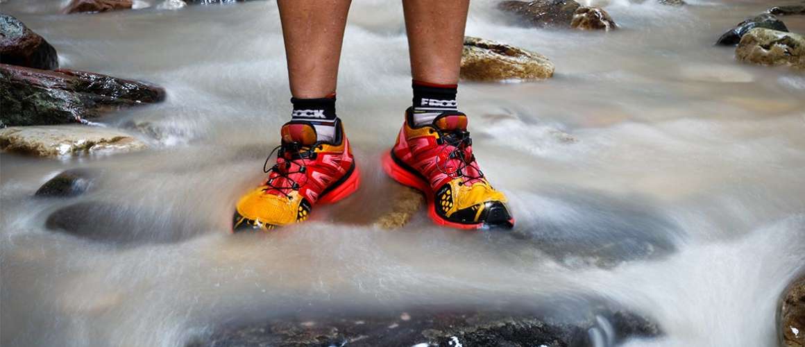
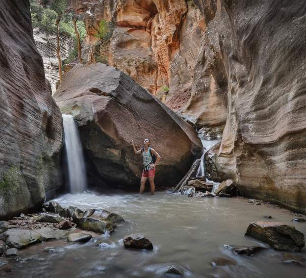
    A favorite destination for adventure seekers. This water hike requires you to hike along and through the stream all the way up the canyon, a 20′ aluminum ladder, and several boulders.

    Due to the uneven terrain, hiking poles and good water shoes are recommended. Hike at your own risk. Never hike alone; remember to tell others where you are going and when you will return. PERMITS ARE REQUIRED.

    Trailhead, turn east on 100 North in Kanarraville and continue to the parking lot.

    *Permits can be obtained at www.kanarrafalls.com.  The cost is $12 per person and is limited to 150 people per day. Once the daily limit is reached, no further permits will be sold. Only credit or debit cards are accepted. No cash payments are accepted and absolutely no refunds. Parking is FREE. For information call the Kanarra Falls Manager, Holly, at (435) 590-7490 or email manager@kanarrafalls.com.


    Spring Creek Trail 5,500 ft.

    MODERATE | 4 MILES | SPRING-FALL | OUT & BACK

    A beginner slot canyon, follow the old jeep trail through meadows into a narrow canyon. Turn around as the trail becomes difficult to pass without equipment. Located at the south end of Kanarraville.

  • Parowan

    Vermillion Castle 7,000 ft.

    MODERATE/STRENUOUS | 2 MILES | SPRING-FALL | OUT & BACK

    The trail is primarily used for hiking, nature trips, and bird watching and is best used from March until October. Use caution as the trail climbs steeply to a ridge spine and continues to a massive red rock cliff. The trail then crosses a sidehill until it comes out to a large flat rock platform with breathtaking views directly into Vermillion Castle and across the canyon to Noah’s Ark. Dogs are able to use the trail but must be kept on leash. Trailhead is 3 miles up Yankee Meadow Road/First Left Hand Canyon from Hwy 143.

    Valentine Peak 8,200 ft.

    STRENUOUS | 3.5 MILES | SPRING-FALL | OUT & BACK

    This hike is very steep. The elevation change is approx 2,000 feet and can be challenging. Trail provides stunning views of the Parowan Valley as it winds up to the peak and back. Trailhead is located at the Parowan Cemetery (485-519 City View Drive, Parowan).

  • Cedar Breaks National Monument (FEE AREA)

    For more information and additional trails, look in the Cedar Breaks National Monument newspaper publication “Breaking News“.

    Alpine Pond Trail 10,400 ft.

    EASY | 2 MILES | SUMMER-FALL | LOOP

    A picturesque walking trail that leads to a surreal alpine pond. Perfect in the summer to view wildlife and wildflowers. Trailhead at the Chessman Ridge Overlook in Cedar Breaks.

    Campground Trail 10,350 ft.

    EASY | 1 MILE | SUMMER-FALL | OUT & BACK

    This trail is an unpaved 1 mile (one-way) trail that connects the Cedar Breaks Visitor Center area to the Campground. Great for viewing birds and park wildlife, and to get away from crowds. This trail spurs off the Sunset trail near the turn-off to the visitor center and ends in the campground.

    Ramparts Overlook/South Rim Trail (formerly Spectra Point Trail 10,350 ft.

    MODERATE | 4 MILES | SUMMER-FALL | OUT & BACK

    A high-country trail winding along the plateau rim; passes a stand of ancient bristlecone pines at Spectra Point and ends at Ramparts Overlook. Trailhead at the Cedar Breaks Fee Station.

    Rattlesnake Creek Trail

    MODERATE TO STRENUOUS | 10 MILES | SUMMER-FALL | OUT & BACK

    Follows Cedar Breaks National Monument boundary across a large alpine meadow and through stands of spruce and fir, descending to Stud Flat and continuing along Rattlesnake Creek to the Ashdown Gorge Wilderness Area. You may return the way you came or for more experienced hikers, continue along the creek or on the Potato Hollow Trail into the Ashdown Wilderness Area to Highway 14. Trailhead is located on Hwy 143 just outside the North boundary of Cedar Breaks National Monument.

    Trail markers are poor or non-existent in places, so hikers should be versed in map reading. Topographic maps of the Ashdown Gorge Wilderness Area are available for purchase in the visitor center. Be prepared to do some wading. Hikers should be advised to check the weather prior to trip in case of flash floods within the gorge.

    *Almost all the trails into the Ashdown Gorge Wilderness Area travel through private property at some point. Please respect the landholders and follow all the guidelines outlined by Leave No Trace.

    Sunset Trail 10,350 ft.

    EASY (ADA ACCESSIBLE) | 2 MILES | SUMMER-FALL | OUT & BACK

    This accessible paves trail, runs between the Point Supreme Overlook and Sunset View Overlook. The park picnic area is located at the halfway point of this trail. Built to offer all ages and abilities the opportunity to enjoy a walk in the woods and avoiding steep grades, this trail provides gentle slopes and offers many rest areas. this is the only trail where pets are permitted.

  • Kolob Canyons, Zion National Park (FEE AREA)

    Timber Creek Overlook 6,500 ft.

    EASY | 1 MILE | YEAR ROUND | OUT & BACK

    Perfect for an afternoon walk, the trail follows the ridge to a small peak, offering views of Timber Creek, Kolob Terrace and Pine Valley Mountains. Trailhead is at the end of Kolob Canyons Road.

    Taylor Creek (Middle Fork) Trail 6,000 ft.

    MODERATE | 5 MILES | SPRING-FALL | OUT & BACK

    Trail follows the middle fork of Taylor Creek in Kolob Canyons; winding past two homestead cabins ending at the Double Arch Alcove. Trailhead is approx. 2 miles past the Kolob Canyons Visitor Center.

    Kolob Arch Trail 6,000 ft.

    STRENUOUS | 14.4 MILES | SPRING-FALL | OUT & BACK

    See one of the world’s largest free-standing arches, Kolob Arch, along LaVerkin Creek. Overnight camping requires a backcountry permit. Trailhead is located 3.5 miles beyond the Visitor Center.

  • Duck Creek & Navajo Lake Trails

    For more information and additional trails in the Dixie National Forest visit www.fs.fed.us/r4/dixie.

    Aspen Mirror Trail 8,400 ft.

    EASY | 1 MILE | SUMMER-FALL | OUT & BACK

    This short but scenic trail brings you to Aspen Mirror Lake. Surrounded by Aspens, it is a spectacular fall destination. Trailhead is located at the end of Forest Service Road 057, about 29 miles east of Cedar City on Highway 14.

    Bristlecone Pine Trail 9,200 ft.

    EASY | 1 MILE | SPRING-FALL | OUT & BACK

    An easy half mile trail that’s great for families. Enjoy views of Zion National Park from an observation deck as you mingle among a grove of Bristlecone Pines. Trailhead is located along Highway 14, near mile marker 17.

    Cascade Falls Trail 9,500 ft.

    EASY/MODERATE | 1 MILE | SUMMER-FALL | OUT & BACK

    Spectacular views of Zion National Park and the Markagunt Plateau, ending at cascading falls from an underground lava tube. From the Duck Creek Visitor Center follow the signs (staying left) approx 3 miles to the trailhead.

    *NOTE: The lava tube is closed to travel due to the low levels of oxygen and high water flows.

    Lost Hunter Trail 9,000 ft.

    EASY | 3.5 MILES | SUMMER-FALL | LOOP

    A loop hike with little elevation gain, Lost Hunter travels through thick pine forests and grasses. Trailhead is located along Forest Road 056, inside Duck Creek Campground.

    Virgin River Rim Trail 9,500 ft.

    MODERATE | UP TO 32 MILES | SUMMER-FALL | POINT TO POINT

    Access from different locations along the trail to customize the distance. Views of the Virgin River Rim and northern terrace of Zion National Park. Hiking, mountain biking and horses. Trailheads at Wood’s Ranch, Deer Haven, Te-Ah Campground, Cascade Falls and Strawberry Point.

    Navajo Lake Loop 9,400 ft.

    MODERATE | 10 MILES | SUMMER-FALL | LOOP

    A moderate 10-mile loop around the beautiful Navajo Lake near Duck Creek Village. The trail is primarily used for hiking, camping, and mountain biking. Heading east on Highway 14, turn right onto Navajo Lake Rd., the trailhead starts off Navajo Lake Rd, on the right-hand side.

  • **LEAVE NO TRACE**

    PLAN AHEAD + PREPARE
    Proper planning and preparation helps hikers accomplish trip goals safely and enjoyably while minimizing damage to natural resources.

    MINIMIZE CAMPFIRE IMPACTS
    If possible, use an existing campfire ring in a well-placed campsite. Choose not to have a fire in areas where wood is scarce.

    DISPOSE OF WASTE PROPERLY
    Pack it in, pack it out – Inspect your campsite for trash or spilled foods. Accept the challenge of packing out all trash, leftover food, and litter.

    RESPECT WILDLIFE
    Keep wildlife wild; observe from afar, avoid disturbing and give them a wide berth, especially during breeding seasons. Never feed wildlife.

    LEAVE WHAT YOU FIND
    Allow others a sense of discovery, and preserve the past. Leave rocks, plants, animals, artifacts, and other objects as you find them.

    TRAVEL ON DURABLE SURFACES
    Damage to land occurs when visitors trample vegetation beyond recovery. DO NOT venture off of the trail.

    BE CONSIDERATE OF OTHERS
    Respect other visitors and protect the quality of their experience. Be considerate of other campers and respect their privacy. Let nature’s sounds prevail. Avoid loud noises and voices. Use headphones to listen to music.

    UTAH SEARCH + RESCUE ASSISTANCE
    Backcountry rescue can be very costly. The USARA card provides you and your family peace of mind and helps support vital search and rescue services. Learn more at secure.utah.gov/rescue.

A favorite destination for adventure seekers. This water hike requires you to hike along and through the stream all the way up the canyon, a 20′ aluminum ladder, and several boulders.

Due to the uneven terrain, hiking poles and good water shoes are recommended. Hike at your own risk. Never hike alone; remember to tell others where you are going and when you will return. PERMITS ARE REQUIRED.

This beautiful slot canyon river hike is located just 13 miles south of Cedar City in the town of Kanarraville. Within the slot canyon resides Kanarra Creek, which supplies the beautiful waterfalls throughout the terrain. Being so close to Kolob Canyon’s section of Zion National Park, the trail is also surrounded by beautiful red rock walls and slick sandstone. The hike has gained notoriety as a favorite destination for adventure seekers, and the peaceful atmosphere and breathtaking views this natural wonder provides are sure to fill the nature lover’s soul.

  • Permitting

    Permits can be obtained at www.kanarrafalls.com or at the trailhead.  The cost is $12 per person and is limited to 150 people per day. Once the daily limit is reached, no further permits will be sold. Only credit or debit cards are accepted. No cash payments accepted and absolutely no refunds. Group permits are no longer available. Parking is FREE. www.kanarrafalls.com/

  • Getting There

    Starting on Cedar City Main Street heading south, turn left to merge onto I-15 S.  Continue south on I-15 for 5.6 miles. Take exit 51 toward Kanarraville/Hamilton Ft., then turn left onto Old U.S. Hwy 91.  Continue on Old Hwy 91 for 4.7 miles. Follow 100 North as it winds east, becomes 250 North, and enters the mouth of the canyon.

    Parking: There is a designated parking area that is free of charge with the purchase of your permit. There are additional parking options with charge if the designated parking is full. Please do NOT park in front of homes or driveways.

  • The Trail

    From the Kanarra Falls parking lot, head through the hiker’s gate and follow the old access road (approximately 0.8 miles) as it wanders up into the Hurricane Cliffs and enters the lower open sections of the canyon.  The trail will cross the stream several times along the road. The road ends by the water well and the trail continues, hiking in the stream most of the time. (You will get wet, and good water hiking shoes are highly recommended.)

    At this point, the trail is mostly overgrown and you will be alternating between hiking in the water (usually less than a foot deep) and hiking on one of the many short trails on both sides of the stream.  Whatever route you choose, please do your best to avoid causing any erosion to the banks. After about a half a mile, the canyon slots up and continues to the first major landmark of the hike: Kanarraville Falls, a 15-foot-high rock-jam waterfall.

    ⚠️ Flooding Updates: Kanarraville Falls Trail

    The first ladder on the Kanarra Falls Trail (pictured) washed away in the flooding that occurred over the weekend. Visitors can still access the falls, though without the ladder you will not be able to climb past.
    At this time refunds are not being issued for permits already purchased. Condition updates and additional information can be found online at kanarrafalls.com or by phone at (435) 233-2467. ⚠️

  • Be prepared and hike and your own risk

    Not Recommended for Small Children

    Kanarra Falls can be considered a family-friendly canyoneering excursion, in that it does not require special gear or climbing equipment; however, it can be challenging for younger children and is not recommended for anyone with physical limitations.  Be aware that there are obstacles to climb over, slippery/uneven surfaces, and unstable ladders to traverse.

    Flash Floods Can Kill

    Kanarra Creek is in a slot canyon and there is a very real danger from flash flooding and rockfall.  Flash floods can occur at any time of year but are most common in July, August, and September during monsoon season. Check the local forecast and remember conditions change quickly; you can also call the National Weather Service at (801) 524-3057.

    *Know your escape routes, be aware of rising water levels, stronger currents, and sudden changes in water clarity.  By entering a narrow canyon or wash, you are assuming a risk. Do not hike this trail if it is raining or if there is a threat of heavy rain. 

    Limited Facilities

    “Go Before You Go” – There is one restroom located near the beginning of the Kanarra Falls Trail as well as one in the town parking lot.  Please pack out ALL your trash (including human waste) and follow the Leave No Trace principles.

    Absolutely NO Pets!

    Leave pets at home – Kanarra Creek is the watershed for Kanarraville town.  Human and animal feces can cause contamination.

    REMEMBER, YOUR SAFETY IS YOUR RESPONSIBILITY!

    Last but not least, HAVE FUN!

  • Plan Your Trip

    Permit required

    • Only credit or debit cards accepted.  
    • No cash payments.
    • No refunds. 
    • Cost is $12 per person. 
    • NO group permits.

    Permits are available at: www.kanarrafalls.com


    Information 

    Call Kanarra Falls Manager, Holly Hadley, at (435) 590-7490 or email manager@kanarrafalls.com.

Cedar City Mountain Biking Trails 

Click here for the Cedar City Mountain Bike Trail Map including: Iron Hills Trail System, Three Peaks Mountain Bike Trail System & Thunderbird Canyons Trail System.

Available trails: Iron Hills Trail System, Three Peaks Recreation Area Mountain Bike Trail System, Nearby Forest Service Trails, Brian Head Trails, Chairlift Accessed Trails and Bike Shuttle Accessed Trails

Iron Hills Trail System provides multiple riding experiences from beginner to advanced. This trail system provides two shuttle options for those who like to ride downhill. You can shuttle to the Greens Lake Trailhead or the “C” Overlook Trailhead.

  • Iron Hills Trail System

    “C” Trail

    Difficult / Advanced | 4.5 Miles | Summer– Fall | Point to Point | Map

    “C” Overlook Trailhead: Take exit 59 on I-15 and head east on Utah Highway 56 / 200 North (1 mi). Turn right/south on Main St. (0.2 mi). Turn left/east onto UT-14 / Center Street (4.9 mi). Turn right/south onto Right Hand Canyon / Kolob Reservoir Rd. (4.3 mi). “C” Overlook will be on the right hand side. No restroom or drinking water available at this trailhead.

    Green Hollow

    Moderate to difficult / Intermediate to advanced  | 2.5 Miles | Spring, Summer & Fall | Point to Point | Map

    Trailhead: Take exit 57 on I-15 and head east on Main St. Turn right on Old Highway 91 which will bend to the south. Take a left onto Greens Lake Dr. and drive to the end of the pavement. Continue east 1.5 miles on the gravel road to the trailhead which will be on the left. No restroom or drinking water is available at this trailhead.

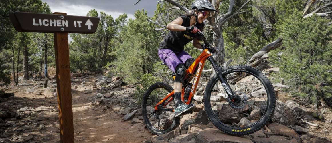
    Lichen It

    Easy/ Beginner | 2.8 Miles | Spring, Summer & Fall | Point to Point | Map

    Lichen It is a broad, smooth trail with a gentle rate of climb. It’s suitable for beginning riders. The trail has two-way traffic.

    Please do not use the trail if it is wet and soft. During the winter, only ride early in the morning after a hard freeze. Try to be off the mountain before things get muddy; start by 8:00 a.m. to 9:00 a.m. (depending on your riding speed).

    Just 1/10 mile from the trailhead, Lava Flow joins on your right. Keep left on Lichen It. (Lava Flow is a one-direction bikes-only flow trail. Do not enter from downhill.) Lichen It will be your path to upper-mountain riding as the trail system is built up. The trail will meander back and forth across the face of the mountain as it climbs the west-facing slope. The rate of climb is consistently easy.

    The surface is 100% dirt with no tricky stuff. The juniper trees are spaced widely enough to allow frequent views to the west. At mile 2.8 from the trailhead, at an altitude of 6550 feet, Lichen It ends (2015). But if you continue straight ahead, you’ll be on the advanced-level Lava Flow trail. Kids and beginners should turn around and descend Lichen It to the trailhead.

    Trailhead: Take exit 57 on I-15 and head east on Main St. Turn right on Old Highway 91 which will bend to the south. Take a left onto South Shurtz Canyon Dr. which will dead end at the Southview Trailhead. Restroom and drinking water available at this trailhead.

    Lava Flow

    Moderate to difficult / Intermediate to advanced | 1.8 Miles| Spring, Summer & Fall | Point to Point | Map

    Trailhead: Take exit 57 on I-15 and head east on Main St. Turn right on Old Highway 91 which will bend to the south. Take a left onto South Shurtz Canyon Dr. which will dead end at the Southview Trailhead. Restroom and drinking water available at this trailhead.

  • Three Peaks Recreation Area Mountain Bike Trail System

    Three Peaks Loop

    Moderate to difficult / Intermediate to advanced | 5.76 Miles | Spring & Fall | Loop | Map

    This advanced ride with up-and-down riding equal to about 1,000 feet of climbing. There are some technical stunts such as Double-take Drop, and some very interesting granite slickrock on the south side. The granite is worth mentioning: This fine-grained pink granite presents a riding surface you won’t find elsewhere in Utah. The traction is good enabling riders to make moves on the granite that can’t be done on sandstone.

    Trailhead: Take exit 57 on I-15 and go west on 200 North / Highway 56 to Lund Highway. Take a right onto Lund Highway heading north. In approximately 5.4 miles, turn left onto Midvalley Rd. heading west approximately 3.1 miles to a dirt parking lot where the trailhead is. Restroom and drinking water available at this trailhead.

    Big Hole Loop

    Moderate / Intermediate | 3.04 Miles | Spring & Fall| Loop | Map

    The Big Hole Loop is an upper-intermediate ride with about 500 feet of climbing. The route follows single track below a rock quarry area on the far side of the mountain. A slightly shorter and easier upper route (used for racing) follows double track above the quarry.

    Trailhead: Take exit 57 on I-15 and go west on 200 North / Highway 56 to Lund Highway. Take a right onto Lund Highway heading north. In approximately 5.4 miles, turn left onto Midvalley Rd. heading west approximately 3.1 miles to a dirt parking lot where the trailhead is. Restroom and drinking water available at this trailhead.

    Race Course Loop

    Moderate / Intermediate | 3.79 Miles | Spring & Fall | Loop | Map

    The race course trail has the best of everything for a mountain bike enthusiast. There are hill climbs, technical areas, sandy terrain and steep downhill portions on this trail, which is almost exclusively single track. This is an intermediate trail with technical portions, but beginners can manage nicely if they walk a couple of very short, rocky, side-tilted areas on the trail.

    Trailhead: Take exit 57 on I-15 and go west on 200 North / Highway 56 to Lund Highway. Take a right onto Lund Highway heading north. In approximately 5.4 miles, turn left onto Midvalley Rd. heading west approximately 3.1 miles to a dirt parking lot where the trailhead is. Restroom and drinking water available at this trailhead.

    Lost World

    Moderate / Intermediate | 0.77 Miles | Spring & Fall | Point to Point | Map

    This trail consists mainly of wider track riding and has very few technical areas. It is the only one of the five trails that is not a loop trail, but by connecting with the Practice Loop or the Race Course Loop can be turned into a longer loop trail.

    Trailhead: Take exit 57 on I-15 and go west on 200 North / Highway 56 to Lund Highway. Take a right onto Lund Highway heading north. In approximately 5.4 miles, turn left onto Midvalley Rd. heading west approximately 3.1 miles to a dirt parking lot where the trailhead is. Restroom and drinking water available at this trailhead.

    Practice Loop

    Easy / Beginner | 1.58 Miles | Spring & Fall | Loop | Map

    This is a beginner trail that given the novice mountain bike rider a chance to practice all the necessary skills before heading out on longer, more technical trails. There are instructional signs along the trail to assist the rider in improving their skill set. Uphill, downhill and sand riding will be experienced on this trail.

    Trailhead: Take exit 57 on I-15 and go west on 200 North / Highway 56 to Lund Highway. Take a right onto Lund Highway heading north. In approximately 5.4 miles, turn left onto Midvalley Rd. heading west approximately 3.1 miles to a dirt parking lot where the trailhead is. Restroom and drinking water available at this trailhead.

  • Nearby Forest Service Trails

    Blowhard Trail

    Difficult / Advanced | 10 Miles | June thru Fall | Point to Point | Map

    The trail follows power-line and ridge spine through a mixed conifer stand, then drops sharply, eventually entering a stand of Bristlecone pine and red ridge looking into Cedar Breaks National Monument and Ashdown Gorge Wilderness Area. View includes a spectacular look at the red rock of the Wasatch Formation. The trail follows closely to the rim’s edge and offers many beautiful sites. It continues downhill through mature stands of spruce, fir, ponderosa, and eventually into aspen before it ends at the junction of Potato Hollow Trail, in Long Hollow, and Cedar Breaks National Monument. Shuttle recommended.

    Trailhead: From Cedar City, travel east U-14 to junction of State Road U-148, (Cedar Breaks Road). Follow U-148 north 1.5 miles to Forest Service Road #277, Blowhard Station Road). Follow the road to power-line radar stations. Follow power-line west to trailhead.

    Boulder Loop

    Easy / Beginner | 1.9 Miles | Winter | Loop | Map

    This is a fat bike trail ONLY and is a mellow loop with overlooks of an ancient lava field and Navajo Lake. Several additional fat bike trails have been added on the west side of Deer Hollow making riding in the winter an added adventure!

    Trailhead: Located at Deer Hollow Recreation Area, 22 miles east of Cedar City on Hwy U-14.

    Navajo Lake Loop

    Easy / Beginner | 1.9 Miles| June thru Fall | Loop | Map

    A winding trail that follows along the side of the lake on the north side and provides views of the lake from above on the south side.

    Trailhead: From Cedar City, follow Highway U-14 east, turn right .5 miles after mile marker 25 at the Navajo Lake Junction (Forest Service Road #30053). Follow the road to the west end of the lake. The trailhead is located just east of the Te-Ah campground.

    Virgin River Rim Trail

    Moderate to difficult / Intermediate to advanced | 32 Miles| June thru Fall | Point to Point/ Out and back | Map / Brochure

    This trail is broken down into three shorter trails making it the perfect trail to customize to your riding preference. This trail provides single track riding with stunning views of Zion and the Pink Cliffs along the rim of the Markagunt Plateau.

    Trailhead: Various access points are located off of Highway U-14 at Deer Haven, Navajo Lake and Strawberry Point.

  • Brian Head Trails

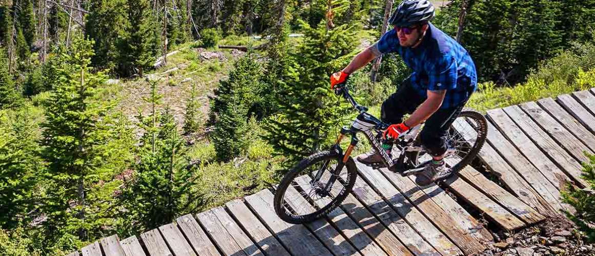
    Over the years, Brain Head has gained fame for its downhill single-track trails that drop from alpine ridges through thick forests to warm valleys. Today, you can hop on the ski resort’s Giant Steps Lift or ride a shuttle van to Brian Head Peak and let gravity be your accelerator. Dark Hollow—Second Left Hand Canyon, Left and Right Forks of Bunker Creek, and Blowhard Mountain are veritable test tracks for today’s “free ride” bikes. Those who prefer to earn their downhills by first riding to mountain summits or who favor marathon cross-country treks will find Brain Head’s trail network accommodating.

  • Chairlift Accessed Trails

    Brian Head Resort’s Mountain Bike Park (Map) offers access to over 200 miles of the area’s most scenic and remarkable single track. The combination of our chairlift and bike shuttle-accessed trail system offers an endless variety of biking options. Learn more at www.brianhead.com.

    The Mountain Bike Park’s trail network is accessed via the Giant Steps Chairlift. Open on the weekends during the summer months, you can enjoy:

    Color Country

    Easy to moderate / Beginner to intermediate | 6 Miles | Summer & Fall | Point to Point

    Heading south from the top of the chairlift, with stunning views of Cedar Breaks National Monument and the red rock vistas of Ashdown Gorge Wilderness Area. As you descend the trail, you will pass an alpine pond in a lush meadow; farther down you will ride along the edge of a small reservoir and into the forest. After riding out of the trees, the trail follows the ridge and back into the ski area boundary as it snakes down the mountain, returning back to the bottom of the lift.

    Lightning Point

    Moderate / Intermediate | 6 Miles | Summer & Fall | Point to Point

    This trail splits off early from the Color Country trail. After crossing UT Hwy 143, you will enjoy open meadows before ascending through the forest overlooking Ashdown Gorge and Cedar Breaks National Monument behind Lightning Point Mountain. Drop into the Upper Bear Flat Campground and coast down UT Hwy 143 a short distance back to the Brian Head Resort Mountain Bike Park.

    Navajo Point Loop

    Moderate to strenuous / Intermediate to advanced | 10 Miles | Early Summer to Fall| Loop | Map

    The Navajo Point Loop receives an advanced rating because you ascend 600 vertical feet on a dirt road, over the course of one mile. The remaining portion of the trail is intermediate. Offering one of the most scenic overlooks in the area, the climb is worth it. Following the signs from the Bear Flat Campground up the dirt road, you will need to watch for signs marking the single track trail that loops behind Navajo Mountain. After looping the mountaintop, you will head north toward the Navajo Chair 4 area, where the trail thunders downhill to meet up with the Town Trail. Heading south will take you back to the Mountain Bike Park.

    Trailhead: From Hwy U-143 in Brian Head, head west on Sugarloaf Mountain Road a short distance to the trailhead.

    Timberline

    Moderate to strenuous / Intermediate to advanced | 4.5 Miles | Summer & Fall | Point to Point

    Heading north as you get off the chairlift, this trail starts out rough, as you roll your way just beneath the 500-foot lichen-covered cliffs of the Brian Head Peak. Eventually it turns back and heads for the trees, near Chair 5. From here, it takes on a new character with tabletop jumps, banked turns, and rollers the rest of the way down! This section of the Timberline Trail is where our downhill races occur, and is a favorite of the locals.

    View Z / Z Line

    Moderate to strenuous / Intermediate to advanced | 3 Miles | Summer & Fall | Point to Point

    This fun technical section directly off the top of the chairlift will zigzag you right into the bottom portion of the Timberline Trail.

    Brian Head Peak Access

    Moderate / Intermediate | 3 Miles | Summer & Fall | Point to Point

    This short ascent around Brian Head Peak is used to gain access to the Sidney Peaks Trailhead and many more mountain bike trail options. This trail crosses the exposed south side of Brian Head Peak and offers some of the most stunning flowery meadow views.

    Town Trail

    Easy/ Beginner | 5.5 Miles | Summer & Fall | Point to Point

    Trail runs along Hwy 143 through Brian Head, providing pedestrian or bicycle access to the various condos, restaurants, and shopping in Brian Head. Riding the Town Trail is great, but combined with one of the Mountain Bike Park’s other trail options, you can ride all day long.

    Trailhead: Access at various points in Brian Head Town, but trailheads exist at the intersection of Aspen Drive and Hwy 143 as well as the Bear Flat Campground.

    Scout Camp Loop

    Moderate to strenuous / Intermediate to advanced | 11 Miles | Summer & Fall | Loop

    Give yourself about one to two hours to complete this loop. Starting out on the Timberline Trail, watch for Scout Camp Loop signs about one mile into the trail. After negotiating the logging roads, you will find yourself in Munoz Meadows, where you will intersect with the Dark Hollow trail. Following this trail into the woods you will see signs for Scout Camp Loop. Heading uphill, you will soon come to Hendrickson Lake on your left. Pass the lake, stay to your right, and then a signed junction awaits you. Riding along the meadow towards the Thunder Ridge Scout Camp area, go about a half-mile until there is a break in the fence and a sign for Brian Head, 3 Miles. If you come to Hwy 143 you went too far. Staying on the single track, a couple of miles later this loops you back into the Town Trail.

  • Bike Shuttle Accessed trails

    The Mountain Bike Park’s access to over 200 miles of single-track, downhill and cross country rides continue by arranging a bike shuttle to:


    Right & Left Fork of Bunker Creek

    Moderate / Intermediate | 12 Miles | Summer & Fall | Point to Point


    Ascending to the rim of the Markagunt Plateau, you are treated with some bumpy, heart-pounding descents that will bring you to a double-track road. From here you will cross over the road, picking the single track back up in a forested meadow. You will see signs for the Left Fork on your right and the Right Fork on your left. Taking the trail on your right (drainages are named from the bottom up), you will find more great drops, weaving you through a spectacular aspen forest. At the bottom of this single track you will cross a stream and go to your right, east on the double-track road. Do not be lulled into thinking that the fun is over. The next 5 miles of double-track are just as fun and challenging. Riding the Bunker Creek Road at the “Y”, follow the signs for Panguitch Lake, until you come to Hwy 143. Using caution, go left on the highway for about a half-mile where you will see the Phillips 66 on your right. Pull in, get a cool drink and wait for your shuttle back to the top.


    Lowder Pond Loop


    Moderate / Intermediate | 11 Miles | Summer & Fall | Point to Point


    A combination of single- and double-track will invigorate as you ride through alpine meadows and aspen forests.

  • Plan Your Trip

    Brochure

    Pick up a “Brian Head Bike & Hike” and “Cedar City Mountain Bike Trail Map” brochure at any local visitor center or bike shop.

    Distance from Cedar City

    Trail distances vary from trail to trail.

    Guides & Outfitters 

    Create the experience of a lifetime by hiring a professional guide or outfitter. 

    National Weather Service

    (801) 524-3057

Ride Southern Utah: Road Cycling in Cedar City

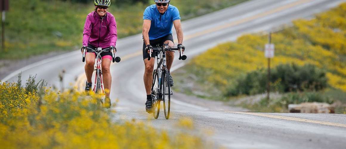
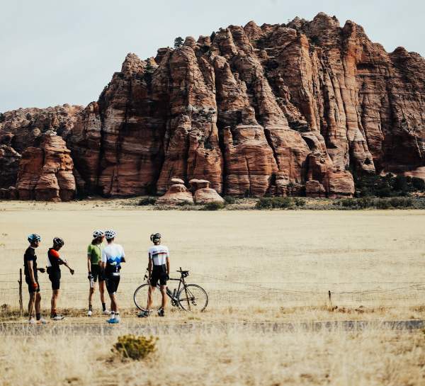
Cedar City is enthusiastic about the world of cycling, being an official host for the Tour of Utah, “America’s Toughest Stage Race” and a major point on the Western Express Bicycle Route, which connects San Francisco, California to Pueblo, Colorado. Cycling in Cedar City not only gives riders the chance to follow in the track of the Tour of Utah, but also scenic, easy rides.

Whether you are in the high mountains or the valley below, be sure you know the Utah Cycling Laws all about road respect by visiting www.RoadRespect.Utah.gov.

Cedar City has designated several miles of bike lanes inside the city limits along major city roads and their arteries for your safety and enjoyment. There’s also the Canyon Trail, which is a wonderful, short, three-mile route for cyclists to enjoy from Cedar City’s Baseball complex into Cedar Canyon. Trail is shared with pedestrians and skate boarders.

Southern Utah Road Rides 

*Courtesy of Craig Egerton & the Color Country Cycling Club

  • Cedar City to Kanarraville to New Harmony

    Best in spring, summer, and fall. Approximately 50 miles round trip, relatively flat, with medium traffic.

    This is an “out and back” ride. Proceed south on Cedar City’s Main Street to the last traffic signal and turn left onto the frontage road Old Hwy 91 and just ride on the frontage road to your heart’s content. If you ride Old Hwy 91 to Kanarraville and back to Cedar, you will have ridden approximately 25 miles. If you want more, there are other options. You can proceed south from Kanarraville (still on the frontage road) to the intersection with I-15 (convenience store) and then come back. If you want even more, you can take either; a) the flatter route to New Harmony and back, (the scenic views of Kolob Canyons on your way back from New Harmony make this worth the trip) or b) proceed south down I-15 to the Kolob Canyons section of Zion National Park. At Kolob there is a great, scenic, five-mile climb, but you will need to pay an entrance fee. To either New Harmony or to Kolob Canyons is about 50 miles out and back.

    This is a good ride when you don’t know how much time you have (you can turn around any time) or when the south winds are strong…ride into them and then have them blow you back to Cedar City. This ride is not advised when winds are out of the north. Traffic along the frontage road is generally very courteous toward bike riders.

  • Parowan Gap Loop

    Best in spring, summer and fall. Approximately 50 miles round trip, relatively flat, with medium traffic.

    From Cedar City Main St/Hwy U-130 and the Mid Valley Road, ride north on Hwy U-130 to the Parowan Gap turnoff (about 13 miles). Turn right and ride through the Parowan Gap Petroglyphs historic site. You may want to get off the bike seat, stretch, and check out the petroglyphs at Parowan Gap while you’re out there. Stay on this road past the dinosaur footprints and continue into Parowan, where it T’s at Main Street. On Main Street, turn right and follow it past the Maverick Gas Station on the right. Continue south down Old Hwy U-91 to the town of Summit. Ride through Summit, over I-15, and continue south on what is now the I-15 (still Old Hwy 91) frontage road until you get back to Cedar City. This is a relatively flat ride of about 50 miles. You may encounter strong winds, but there is not a lot of climbing.

  • Mammoth Creek Loop

    Best in mid-summer. 35 miles, lots of climbing, medium to heavy traffic.

    *Hwy U-148 is only open late May through October. Begin at the intersection of Hwy U-14 and Hwy U-148, about 18 miles east of Cedar City. Climb north on Hwy U-148 through Cedar Breaks National Monument be sure to stop at the visitor center and take in some of the overlooks. At the junction of Hwy U-148 and Hwy U-143, turn right. This is a fun downhill stretch, but you will want to watch for signs to Mammoth Creek. The Mammoth Creek Road will be the first paved road that turns to the right (south). Take the Mammoth Creek Road south to Hwy U-14. Turn right on Hwy U-14 and climb back up to where the car is parked. This ride is about 35 miles long and involves A LOT of climbing.

    Make sure you are in good physical condition. Elevations are 8,000 to 10,000 feet above sea level and altitude can be a problem. Also, bring clothing that will allow you to adapt to sudden changes in weather (rain, drops in temperature, etc.) that can happen in the mountains in the summertime.

  • Quail Lake Loop

    Best in fall and spring. Approximately 27 miles, medium to heavy traffic, narrow shoulder.

    Drive on I-15 to the Toquerville Exit #27 at Anderson Junction. There is plenty of parking on the east side of the freeway. This is a loop ride that is best done in a clockwise direction. Ride along Hwy 17 through Toquerville, LaVerkin and Hurricane. Travel west out of Hurricane on Hwy U-9 to the Quail Creek Reservoir turnoff. Turn north and climb towards Quail Creek Reservoir until you come to the I-15 frontage road. Follow it north through Leeds and back to where the car is parked.

    Cautions include high winds. Hwy 17 between Toquerville and LaVerkin has a fair amount of development traffic and a narrow shoulder; the shoulder of Hwy U-9 can be pretty dirty, so watch for flats. There is a substantial (not huge) amount of climbing on this route. The loop is about 27 miles long. An option to this ride is an out and back to Zion National Park. To take this option, at LaVerkin, turn east on Hwy U-9 and follow the signs to Zion. This is an out and back of about 20 miles.

  • Veyo Loop

    Best in fall and spring.

    Start in the town of Ivins at the fire station and meander through the Keyenta subdivision until you get onto Old Highway U-91. Head west on Hwy U-91 to the Gunlock Reservoir turnoff. Take it and climb north past Gunlock Reservoir, through the town of Gunlock and into Veyo. There is a little general store in Veyo to rest up and replenish food and water. From Veyo, turn south down Hwy U-18 to the Snow Canyon State Park turnoff. There may be a small admission fee to ride back through the state park. When you exit Snow Canyon State Park, continue south until you come to a T intersection. Turn right at the T and follow it due west back to the fire station. There is a substantial amount of climbing on the first half of this ride with a similar amount of fun downhill on the return trip.

  • Plan Your Trip

    Contact

    Cedar City

    Visitor Center

    581 N. Main

    Cedar City, UT 84721

    Phone

    (435) 586-5124

    Hours

    Mon-Fri: 8:30 a.m. – 5:00 p.m.

    Saturday: 9:00 a.m. – 5:00 p.m.

    Sunday: 9:00 a.m. – 5:00 p.m.

Drop your fishing line into a lake or stream and chances are you’ll pull up a rainbow, German brown, or brook trout. Color Country has 20 reservoirs, 9 natural lakes, and 10 creeks and rivers that are open and stocked for fishing. Which is the best is a matter of opinion because every single place is some fisherman’s secret spot.

In addition to the excellent trout fishing, Color Country has bass fishing at Gunlock and Quail Creek reservoirs, and Lake Powell. Stop at any of Color Country’s visitor centers for specific locations of the reservoirs, lakes and rivers. You’ll probably get a few suggestions on the best fishing spots to try. Since fishing regulations vary, pick up a copy of the Utah Fishing Proclamation at any location where Utah fishing licenses are sold. You can also obtain a license and proclamation at the Utah Division of Wildlife Services website: www.wildlife.utah.gov or call (435) 865-6100.

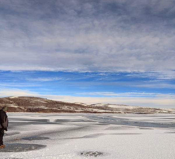
When the lakes freeze over, ice fishing becomes a relaxing winter pastime. Panguitch Lake, Otter Creek, Minersville and Wide Hollow reservoirs are popular winter fisheries. Always remember to check the ice thickness and weather conditions before ice fishing!

  • Reservoirs

    Anderson Meadow

    65 miles east of Cedar City, via I-15 to Beaver, then east on U-153 to Kent’s Lake Rd. Rainbow, brown, brook and cutthroat trout. Unimproved camping and car accessible (summer and fall only).

    Baker

    55 miles south west of Cedar City, via Hwy 56 to Hwy 18. Rainbow, brown, brook and cutthroat trout. Improved camping and car accessible (summer and fall only).

    Duck Creek

    28 miles east of Cedar City on Hwy 14. Rainbow, brown, brook and cutthroat trout. Improved camping and car accessible (summer and fall only).

    Enterprise

    45 miles west of Cedar City, via Hwy 56 to the town of Enterprise, then follow the signs. Rainbow, brown and brown trout. Improved camping; boating and car accessible. 

    Gunlock State Park

    55 miles southwest of Cedar City, via Hwy 56 to Hwy. 19. Turn right at Shivits Indian Reservation. Bass and crappie fish. Improved camping; boating and car accessible.

    Kolob

    First right-hand turn off Hwy 14, then 20 miles south on good gravel road. Rainbow, brown, brook and cutthroat trout. Unimproved camping; boating and car accessible (summer and fall only).

    Lake Powell

    3 hours southeast from Cedar City, via Hwy 89. Rainbow, bass, crappie, catfish. Improved camping, boating and car accessible, marina, all services available.

    Little Reservoir

    62 miles northeast of Cedar City, via I-15 to Beaver, then east on Hwy 153. Rainbow, brown, brook and cutthroat trout. Unimproved camping and car accessible (summer and fall only).

    Minersville State Park

    50 miles north of Cedar City, via Hwy 130 to Hwy 21. Rainbow trout and bass. Improved camping; boating and car accessible.

    Newcastle

    30 miles west of Cedar City, via Hwy 56, turn left at Newcastle town and follow signs. Rainbow trout and bass. Unimproved camping; boating and car accessible.

    Paragonah

    10 miles northeast of Parowan, via Old Hwy 91 to Paragonah town, follow signs east of the town. Rainbow trout. Unimproved camping and car accessible (summer and fall only).

    Pine Valley

    40 miles west of Cedar City, via Hwy 56 to Hwy 18, turn east at Central. Rainbow trout. Unimproved camping and car accessible (summer and fall only).

    Quail Creek State Park

    38 miles south of Cedar City, via I-15 to Hwy 9. Rainbow trout, bass and bluegill. Improved camping, boating, and car accessible.

    Three Creeks

    62 miles northeast of Cedar City, via I-15 to Beaver, then east on Hwy 153. Rainbow, brown, brook trout. Unimproved camping and car accessible (summer and fall only).

    Tropic

    79 miles east of Cedar City, Hwy 14 to Hwy 89 to Hwy 12, turn right on East Fork of Sevier River road and follow signs. Rainbow and cutthroat trout. Unimproved camping and car accessible (summer and fall only).

  • Lakes

    Yankee Meadow

    10 miles southeast of Parowan, via Hwy 143, turn left at the five-mile marker onto a good gravel road. Rainbow and cutthroat trout. Unimproved camping and car accessible (summer and fall only).

    Kent’s Lake

    62 miles northeast of Cedar City, via I-15 to Beaver, then east on Hwy 153. Rainbow, brown, brook, and cutthroat trout. Unimproved camping and car accessible (summer and fall only).

    Kid’s Pond

    14 miles east of Cedar City, via Hwy 14. Rainbow & brook trout. Unimproved camping and car accessible (summer and fall only). Kids only — must be with an adult with a valid Utah fishing license.

    Le Baron Lake

    62 miles northeast of Cedar City, via I-15 to Beaver, then east on Hwy 153. Rainbow, brook, and cutthroat trout. Unimproved camping and car accessible (summer and fall only).

    Navajo Lake

    24 miles east of Cedar City, via Hwy 14. Rainbow, brown, brook, and cutthroat trout. Unimproved camping and car accessible (summer and fall only).

    Panguitch Lake

    20 miles east of Brian Head, via Hwy 143. Rainbow, brown, brook, and cutthroat trout. Improved camping; boating and car accessible.

    Pine Lake

    79 miles east of Cedar City, via Hwy. 14 to Hwy 89 to Hwy 12, turn left at Bryce Canyon Junction, follow signs. Rainbow, brown, brook, and cutthroat trout. Improved camping and car accessible (summer and fall only).

    Asay Creek

    35 miles east of Cedar City, via Hwy 14 to Hwy 89, head north. Rainbow, brown, brook, and cutthroat trout. Car accessible.

    Beaver River

    55 miles north of Cedar City, via I-15 to Beaver, then east on Hwy 153. Rainbow, brown, brook, and cutthroat trout. Unimproved camping and car accessible (summer and fall only).

    Mammoth Creek

    30 miles east of Cedar City, via Hwy 14, turn left at Mammoth Creek Rd. Rainbow, brown, brook, and cutthroat trout. Car accessible (summer and fall only).

    Panguitch Creek

    20 miles east of Brian Head, via Hwy 143. Rainbow, brown, brook, and cutthroat trout. Car accessible (summer and fall only).

    Parowan Creek

    5 miles from Parowan, via Hwy 143. Rainbow, brown, brook, and cutthroat trout. Car accessible (summer and fall only).

    Sevier River

    35 miles east of Cedar City, via Hwy 14 to Hwy 89. The river runs along Hwy 89. Rainbow, brown, brook, and cutthroat trout. Car accessible

    Virgin River — East Fork

    65 miles south of Cedar City, via I-15 to Hwy 9. The river runs along Hwy 9 to Zion National Park. Rainbow, brown, brook, and cutthroat trout. Improved camping and car accessible.

    Virgin River — North Fork

    29 miles east of Cedar City, via Hwy 14 to Navajo Lake, turn right on lake road. Rainbow, brown, brook, and cutthroat trout. Car accessible (summer and fall only).

  • Plan Your Trip

    Licenses

    Fishing licenses are available at most sporting good centers throughout Southern Utah. Since fishing regulations vary, pick up a copy of the Utah Fishing Proclamation while getting your license.

    Distance from Cedar City
    Locations vary

    Guides & Outfitters
    Create the experience of a lifetime by hiring a professional guide or outfitter. 

    More Info

    Utah Division of Wildlife Services

    1470 N. Airport Rd.

    Cedar City, UT 84720

    (435) 865-6100

    www.wildlife.utah.gov

While Cedar Ridge is probably not as well-known as some of the courses to the south, but it is one of the state’s finest community operated courses. 

The beautiful scenery, teeing within minutes of arriving and knowing that you can play in seclusion without being rushed through your normal round is pure relaxation. The course also has a well-stocked pro golf shop and clubhouse with a snack bar and is friendly enough for beginners with plenty of challenges for the seasoned golfer. This stimulating yet carefree 18-hole course and is open year-round (as long as there’s no snow on the greens).

  • Take a Lesson

    If you are feeling rusty or have never played, Cedar Ridge Golf Course has two professional instructors to teach the basics, provide tips, improve individual games and teach new techniques. Inquire at the Pro Shop.

  • Practice Range

    Three practice areas are available to help you fine-tune your game, including a full length practice range, a chipping area and a practice putting green.

  • Plan Your Trip

    Getting there

    Cedar Ridge golf course is located at 200 East 900 North just off of Main Street across from the city cemetery. Any questions you may have can be answered by calling the pro shop at (435) 586-2970.

    Hours of Operation

    Summer: from 6:30 a.m. – 9 p.m.

    Winter: from 7 a.m. – 6 p.m

    Guides & Outfitters 

    Create the experience of a lifetime by hiring a professional guide or outfitter. 

    More Info

    Cedar Ridge Golf Course 

    200 E. 900 N.

    Cedar City, UT 84720

    (435) 586-2970

    www.CedarCity.org

A rapidly growing sport of Frisbee-like discs thrown into specially made baskets along an 18-hole course. Five courses are accessible year-round in Cedar City, Enoch, or Parowan, and one summer course in Brian Head.

  • Three Peaks Recreation Area

    Three Peaks Course – West Midvalley Road

    Distance: 8,442 ft.

    18 HOLES | ADVANCED | Par: 62 | Bathroom: YES | Water: NO

    This is a large, rugged, high desert course. Incredible terrain and beautiful views. Unique rock formations, canyons, juniper trees, and sagebrush with lots of elevation changes. Innova DISCatcher baskets, large concrete tee pads, and excellent signage. Alternate pin placements and alternate/shorter tees on all the par 4’s and 5’s.

    Ironside – West Midvalley Road

    Distance: 
    White baskets 6,761 ft.
    Orange baskets 7,444 ft.

    18 HOLES | ADVANCED | Par: White baskets 59 – Orange baskets 63 | Bathroom: YES | Water: NO

    Ironside is an 18 hole course with beautiful views, unique natural obstacles, and amazing pin locations. The Ironside course has double baskets for each hole, creating two courses in one.

  • Cedar City

    Thunderbird Gardens – Thunderbird Gardens Trailhead, Cedar City

    Distance: 4,732 ft.

    18 HOLES | EASY/INTERMEDIATE | Par: 55 | Bathroom: YES | Water: NO

    Located just off of Main Street in Cedar City, this beautiful 18-hole hiking course plays through epic red rock formations and features unique challenges for all skill levels to enjoy! The bottom 9 holes are more geared towards novice players and can be played in about an hour. For more advanced play try the upper 9 holes.

  • Parowan Canyon

    South Course – Parowan Canyon

    Distance: 1,810 ft.

    9 HOLES | EASY | Par: 27 | Bathroom: NO | Water: NO

    This is a novice course that’s great for beginners, families, and tourists, but is also adventurous and technical enough for more skilled players. It weaves through a beautiful canyon near a creek just 12 miles from Brian Head Resort.

    North Course – Parowan Canyon

    Distance: 5299 ft.

    18 HOLES | INTERMEDIATE | Par: 56 | Bathroom: NO | Water: NO

    This is a longer, slightly more challenging course than the South Course. Most holes are still under 300 feet though. There are a few over 300 feet, and two Par 4’s that are over 525 feet. The course weaves through a beautiful canyon near a creek just 12 miles from Brian Head resort. The creek comes into play on several holes.

  • Brian Head

    Brian Head Summer Course – Brian Head Resort

    Distance: 9,900 ft.

    18 HOLES | INTERMEDIATE | Par: 81 | Bathroom: YES | Water: YES

    Long, challenging mountain course. 1st tee at 10,920 feet. Take the lift ($) (or hike for free). The course generally takes two to two and a half hours to complete, depending on your ability level. It is suggested that you are prepared for alpine conditions, bring: sunscreen, sunglasses, adequate water, and hiking shoes. Temperatures at high altitudes are cooler, dress accordingly i.e. windbreaker and or raingear.

  • Purchase, Rent, & Loan Discs

    Brian Head Activity Center: purchase/rent

    Cedar City Visitor Center: rent

    Cedar City Bureau of Land Management: loan

    Cedar Sports: purchase

    Enoch City Office: loan

    Parowan Welcome Center: loan

    Sportman’s Warehouse: purchase

    SUU Outdoors: rent

    Walmart: purchase

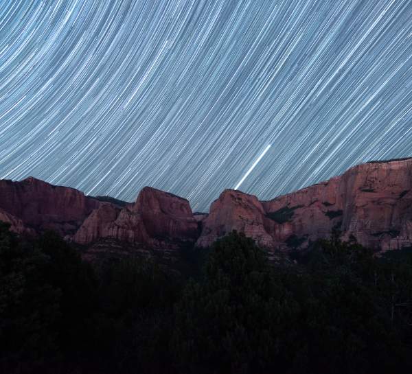
Due to the lack of light pollution, we are fortunate here in Southern Utah to be able to view natural phenomena in the skies above. Portions of Iron County remain some of the darkest and best places in the world to view the night sky. Many nighttime visitors to Cedar Breaks National Monument get to see more stars than they’ve ever seen in their lives… even when the moon is out!

  • Cedar Breaks National Monument

    In March 2017, Cedar Breaks National Monument was officially designated as an International Dark Sky Park by the International Dark Sky Association, a nonprofit that works to combat unnecessary light pollution worldwide. This designation recognizes Cedar Breaks as a night sky sanctuary, the first of its kind in southwest Utah. Such recognition is timely, because places like Cedar Breaks are disappearing rapidly.

  • Around Town

    When you head out at night to stargaze be prepared for a cool night. Let your eyes adjust to the wonders above.

    Look for a place that lacks a lot of artificial light, like a city park or open field. Find the Big Dipper. The last two stars in the cup of the Big Dipper point to the North Star, which is just a bit dimmer than the individual stars in the Big Dipper.

    To find more constellations, download a stargazing app like SkyView©, Night Sky© or Pocket Universe©. You can pick up constellation maps from the Cedar City Visitor Center, located at 581 N Main St, or download the PDF constellation maps here: Year Round Constellations, Spring Constellations, Summer Constellations, Autumn Constellations.

    To help navigate at night without compromising your night vision, make a red flashlight. Use red paper or cellophane to cover a white flashlight.

    Attend a Star Party at Cedar Breaks National Monument (www.nps.gov/cebr) or with the Southern Utah Space Foundation (www.SUSF.org). There you can find amateur astronomers and experts sharing views through their telescopes.

    Check out a telescope! Just like a book, you can check out a high-quality telescope from the Cedar City Library located at 303 North 100 East.

  • In the Forest

    Look for the Milky Way stretching across the night sky. What looks like a faint cloud is actually the light from millions and millions of distant stars. The Milky Way is our home galaxy and is best seen in summer and fall evening skies.

    If the full moon is up, the Milky Way will be hard to see. Try going for a night hike instead! Let your eyes adjust to the moonlight and keep your flashlight turned off (but available for safety if needed) or use the red flashlight you made.

  • In a National Park

    Camp under the stars. Watch the stars and planets move across the night sky.

    National parks are great places to get to know the animals that are nocturnal—wildlife that is awake at night and asleep during the day. Sit quietly and listen for these creatures.

    Many national parks, including Cedar Breaks National Monument, Bryce Canyon and Great Basin offer night sky programs from star parties to full moon walks with rangers.

    To learn more about the night sky, upcoming astronomy events, stargazing activities and simple things you can do to protect the night sky for future generations, go to these websites:

    We hope that our designation as an International Dark Sky Park will inspire more people to appreciate the beauty of the night sky and take some simple actions to help protect it.

  • Losing the Dark

    Less than 100 years ago, everyone could look up and see a spectacular starry night sky. Now, millions of children across the globe will never experience the Milky Way. Increased use of artificial light at night is not only impairing our view of the universe, it is adversely affecting our environment, safety, energy consumption and health.

    What is Light Pollution?

    Light pollution is a side effect of industrial civilization. The fact is that much outdoor lighting used at night is inefficient, overly bright, poorly targeted, improperly shielded, and, in many cases, unnecessary. This light, and the electricity used to create it, is being wasted by spilling it into the sky, rather than focusing it on to the actual objects and areas that people want illuminated.

    The International Dark Sky Association (IDA) estimates that least 30 percent of all outdoor lighting in the U.S. alone is wasted, mostly by lights that aren’t shielded. That adds up to $3.3 billion and the release of 21 million tons of carbon dioxide per year! To offset all that carbon dioxide, we’d have to plant 875 million trees annually.

    Effects of Light Pollution 

    For three billion years, life on Earth existed in a rhythm of light and dark that was created solely by the illumination of the Sun, Moon and stars. Now, artificial lights overpower the darkness and our cities glow at night, disrupting the natural day-night pattern and shifting the delicate balance of our environment.

    Plants and animals depend on Earth’s daily cycle of light and dark rhythm to govern life-sustaining behaviors such as reproduction, nourishment, sleep and protection from predators. Like most life on Earth, humans adhere to a circadian rhythm, a sleep-wake pattern governed by the day-night cycle. Artificial light at night can disrupt that cycle.

    The negative effects of the loss of this inspirational natural resource might seem intangible. But a growing body of evidence links the brightening night sky directly to measurable negative impacts including:

    • Increasing energy consumption  
    • Disrupting the ecosystem and wildlife
    • Harming human health                  
    • Affecting crime and safety

    Light pollution affects everyone. A growing number of scientists, homeowners, environmental groups and civic leaders are taking action to restore the natural night. Each of us can implement practical solutions to combat light pollution locally, nationally and internationally.

    You can help!

    The good news is that light pollution, unlike many other forms of pollution, is reversible and each one of us can make a difference! Start by minimizing the light from your home at night:

    • Only use lighting when and where it’s needed; if safety is a concern, install motion lights
    • Properly shield all outdoor lights
    • Keep your blinds drawn to keep light inside
    • Become a citizen scientist and help measure light pollution

    Learn more at darksky.org. Then spread the word to your family and friends!

  • Plan Your Trip

    Astronomical Events

    Star Parties

    Saturdays | Memorial Day – Labor Day | 8 p.m. 

    — Point Supreme

    Beginning shortly before sunset, Cedar Breaks National Monument rangers begin the party with a night-sky talk. Visitors will have a chance to enjoy a look at the stars through several large telescopes, constellation tours, star stories and mythology. Reservations are not needed. 

    nps.gov/cebr or (435) 586-9451

    Campfire Concert

    September | 6 p.m. – 9 p.m. — Cedar Nature Park

    Campfire Concerts in the Canyon showcase live music, a roaring fire, fixings for s’mores and plenty of fun. Stick around after the music to hear a legendary local tale or two. The Cedar Canyon Nature Park is located about 1 mile east of Cedar City along Highway 14. 

    gowildlife.org or (435) 586-4693

    Astronomy Festival 

    September | Second Weekend

    — Southern Utah

    A regional celebration of astronomy and dark skies. The festival will consist of events for all ages taking place throughout Southwest Utah. Come experience night sky art exhibitions in Cedar City, attend a star party at Cedar Breaks, go on a night hike in Zion, and look at the sun from downtown St. George. 

    nps.gov/cebr or (435) 586-9451

    Fall Equinox

    September | Fourth Saturday | 6 pm 

    — Parowan Gap

    The Fall Equinox Observation includes a presentation of the ancient Native American solar calendar, guided interpretive tour, hike and observation of the fall equinox sunset. Be sure to wear good walking shoes and bring water to drink.

    visitcedarcity.com or 

    (435) 463-3735

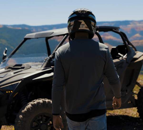
Dirt roads and trails left from the pioneer days ribbon through southern Utah’s landscape, making for some of the best off road (OHV) riding in the state. There are over 400 miles of designated trails in the high mountain passes of the Dixie National Forest area of the Markagunt Plateau and with nearly more 500 miles of trails designated near Parowan Gap in 2017. Three Peaks Recreation Area west of Cedar City is becoming famous with 4 x 4 rock crawlers.


OHVs (Off-Highway Vehicles) include any snowmobile, ATV, motorcycle, or other off-highway vehicles capable of travel over unimproved terrain. Only registered OHVs may be operated on public lands or roads that are signed or designated as open to OHV use. Do not operate your OHV on private land without the owner’s permission.

Color County Trail System


The Color County OHV Trail System is a network of trails off-road enthusiasts can enjoy throughout Iron County in southwest Utah. The system connects to other trail segments in adjoining counties so you can enjoy the magnificent scenery found throughout the area, including the southern end of the Paiute trail and the High Desert Trail. The Color Country System is broken into segments with their own core trails and loops. Each loop is identified by name and marked with signage. There are some segments still under development, so please check back on the trail’s website, ironcounty.net/trails, for updated information and maps. You can download maps onto your GPS device or cell phone using the AVENZA maps app.

Trail map: www.ironcounty.net/trails/

Dixie National Forest — Markagunt OHV System


The Markagunt OHV System is located on the Markagunt Plateau of the Dixie National Forest in southwestern Utah. The system is made up of roads and trails that travel through mixed conifer forests and wide-open meadows. The landscape of the plateau is influenced by ancient volcanic activity with volcanic peaks and rough lava fields. Surrounded by several National Parks and Monuments, the roads and trails in the system offer outstanding views of the contrasting forested plateaus and the lower red rock canyons.

Trail map

  • Responsible OHV Use

    Utah’s off-highway vehicle (OHV) laws and rules promote safety and protection for people, property, and the environment. While being operated or transported on public lands or roads, OHVs must display a current OHV registration sticker. Off-highway motorcycles may be registered as street legal, if they are safety inspected and insured, or as off-highway vehicles.

    Obtain registration from the local Utah Division of Motor Vehicles.

    If you are a nonresident visiting Utah, please go to this website: www.stateparks.utah.gov.

    Who can operate OHVs on public lands or roads?
    No one under eight years of age may operate an OHV on public roads, trails, or lands. Drivers from eight to 15 years of age must possess an OHV education certificate issued by the Utah Division of Parks and Recreation. Drivers 16 years of age and older must possess a valid driver’s license or an OHV education certificate.

    Education certificates will be issued to anyone eight years old and older who completes the Utah Division of Parks and Recreation OHV education course or passes an OHV knowledge and skills test. Contact the Division for Education information at (800) OHV-RIDE.


    What about helmets?
    Properly fitted, safety-rated helmets must be worn by OHV drivers and passengers under 18 years of age. All drivers and passengers of any age should wear protective head gear.

    Other OHV Laws:

    • Ride only in areas designated as open to OHVs.
    • Ride on the right side of the road and in single file.
    • Be alert to oncoming traffic, especially on blind curves or in dips and on hill crests.
    • It is illegal to drive an OHV while under the influence of alcohol or drugs.
    • A brightly colored “whip flag” must be attached to OHVs when riding in sand dune areas.
    • Lights must be used between sunset and sunrise.
    • Be sure your brakes will control and stop your OHV.
    • Mufflers are required on all OHVs.

  • Must See & Do Three Peaks

    Iron County and the Bureau of Land Management have teamed up to develop the Three Peaks Recreation Area west of Cedar City. The rolling hills and volcanic rock formations at Three Peaks provide a fantastic location for picnicking, camping, bike riding and off-road vehicle use.
    (435) 867-7329 | www.ironcounty.net

  • Emergency Numbers

    Emergency
    911

    Utah Highway Patrol

    (435) 586-9445

    Iron County Sheriff 

    (435) 867-7500

    Kane County Sheriff

    (435) 644-2349

    Garfield County Sheriff

    (435) 676-2678

    National Weather Service

    (801) 524-3057

    press 1 for flash flood; press 1 for local forecast; 25 for southwest Utah (Beaver, Cedar City, Fillmore)

    Report a Fire

    (435) 865-4600

    Poaching Hotline

    (800) 662-DEER

    Forest Service Law Enforcement

    (435) 865-3200

  • Plan Your Trip

    Brochure

    Pick up a “Dixie National Forest Travel Map” and the “Color County Markagunt and Parowan Gap OHV Segments Map” at visitor centers in Cedar City, Parowan or Brian Head, any Dixie National Forest Service office or OHV dealer.

    Distance from Cedar City

    Trail distances vary from trail to trail.

    More Info

    Cedar City Ranger District
    Dixie National Forest

    1789 North Wedgewood Lane 

    Cedar City, Utah 84720 

    (435) 865-3200

    www.fs.usda.gov/dixie

    Utah Division of Parks and Recreation 

    1594 West North Temple

    Suite 116 Box 146001 

    Salt Lake City, UT 84114-6301 

    (801) 538-7220 

    www.stateparks.utah.gov/ohv

    Bureau of Land Management 

    Cedar City District

    176 East D.L. Sargent Drive 

    Cedar City, UT 84720-9337

    www.blm.gov

    National Weather Service

    (801) 524-3057

Some of the nation’s best snow conditions occur year after year in the mountains east of Cedar City. The snow conditions and terrain on Cedar Mountain, including Dixie National Forest and Cedar Breaks National Monument, are some of the best in the country for cross-country skiing and snowshoeing.

Located 22 miles from Cedar City off Highway 14, Dixie National Forest’s Deer Hollow is ideal for cross-country skiing, snowshoeing and fat biking. There are nearly 37 kilometers (23 miles) of groomed cross-country ski trails, with loops designed for every level and type of skier, and more than 2.5 kilometers (1.6 miles) of snowshoe and fat bike trails on the east side of the recreation area that lead you to the stunning Lava Field and Navajo Lake Overlooks. For a PDF of the Deer Hollow Winter Recreation Area click here.

Cedar Breaks National Monument is also a fave for cross-country skiing. Park at the junction of Highway 143 and Highway 148, then follow the groomed trail for spectacular views at the Chessman Overlook. Stop at the warming yurt (weekends only) for hot cocoa and conversation with a park ranger. Cedar Breaks’ staff also offers free guided snowshoe hikes every Saturday throughout January and February.

  • Safety Tips

    • Advise someone of where you are going and the time period you expect to return.
    • Make sure to always wear clothes in layers, which enable an individual to adapt to changing weather conditions.
    • Check weather and avalanche danger forecast before setting out on a ride.
    • Don’t harass the wildlife!

  • Extreme Conditions

    Frostbite

    Hopefully you will never have to experience frostbite, but if it should set in, you should know how to spot it. Frostbite is caused by exposing unprotected flesh to freezing temperatures for a prolonged period of time. Those body parts that pose the most risk are your fingers, toes, nose, and ears. The damage occurs when the flow of blood to these parts is reduced. The symptoms of frostbite are loss of feeling and a dead white appearance. To treat frostbite you need to restore the body’s temperature as quickly as possible by providing heat externally. This may include such things as a hot water bottle, a campfire, or immersion in water baths with a temperature less than 110 degrees. The affected body areas must be covered immediately. Make sure not to rub, vibrate, or apply pressure to the affected areas. Snow or cold water should not be applied to the frostbitten areas.

    Hypothermia

    Hypothermia poses the greatest danger to winter enthusiasts. This happens when the body loses heat faster than it can produce it, draining energy from the body. The main way to prevent hypothermia is to wear layered clothing. The factors that contribute to hypothermia are cold weather, wetness, wind and the wind chill factor, and exhaustion. Symptoms include uncontrolled shivering, fumbling hands or stumbling walk, vague or slurred speech, memory lapse, drowsiness and apparent exhaustion. The treatment of hypothermia begins with removing the victim from the harmful environment that caused the condition. This may be achieved by setting up a shelter or moving to a timbered area. From here, proceed to remove the individual’s wet clothing and place them in dry clothing or a sleeping bag. Added warmth may be achieved by getting in the bag with the person. If warm liquids are available, give them to the person, but never give them alcohol. If the victim is conscious, give them sugary foods that can provide them with a quick energy fix. Try to keep the person dry and warm and seek medical help as soon as possible.

    Avalanche Danger

    If you are caught in an avalanche you should immediately call out to others in hopes that they can see your course. It is very important to stay calm. Make an attempt to move away from your equipment and machine. Try to swim with the avalanche in an attempt to reach the side of it. Never swim against the avalanche. As you are coming to a stop, thrash your limbs about in hopes of loosening up the snow around you. Before coming to a stop, place your hands over your face to create an air pocket for breathing. If you are completely covered by snow the only way to gauge which way is up is to spit saliva and gravity will lead the way. Be sure to dig up. If you survive an avalanche, don’t desert the other victims. Stab your pole into the snow directly downhill from the point they were last seen.

    The new statewide telephone number for avalanche forecast updates is (888) 999-4019 or go to the Utah Avalanche Center website.

  • Plan Your Trip

    Brochure

    Cedar Mountain Nordic Ski Map

    More information

    Cedar Mountain Nordic Ski Club (CMNSC)

    A nonprofit group formed for the purpose of promoting cross-country skiing in the Cedar City/Brian Head area and to educate the public about the benefits of Nordic skiing. Please visit CMNSC at www.meetup.com/cedar-nordic for trail descriptions and maps, or call.

    Dorothy and David Uherka at (435) 867-4644.

    Dixie National Forest

    District Headquarters

    1789 N. Wedgewood Dr

    Cedar City, Utah 84720

    (435) 865-3200

When the temperatures drop and snow falls, the winter just heats up with skiing and snowboarding in Southern Utah. Utah is famous for having the “Greatest Snow on Earth” and we are fortunate to have a ski resort here in the heart of the red rock country of Southern Utah Brian Head Resort.

While Brian Head has gone through some major renovations to modernize their amenities, they still take an old-school approach to running the mountain. This place has everything you want out of a Utah ski resort: the same dry Utah powder as her sisters to the north but with ticket prices that don’t break the bank. Brian Head is a mellow ski resort where everyone knows your name and you’re treated like family minus the weird uncle and the head noogies.

Brian Head Resort receives over 400 inches of famous Utah powder every year and features Utah’s highest base elevation at 9,600 ft. with a lift-served vertical drop of 1,320 ft. from Giant Steps. With renovated lodges, new tubing hill, new night skiing options, and magic carpet surface lifts, Brian Head has improved the overall experience. The resort offers over 650 acres with eight chairlifts and 71 runs. Take flight with revamped terrain parks that offer countless features for all skill levels. The Training Grounds Terrain Park consists of over 20 features for all skill levels with a dedicated park crew for the two progressive park areas, allowing you to improve your park skills with a state-of-art set up.

Amidst a stunning alpine backdrop, Eagle Point offers five lifts with access to over 400 skiable acres and 40 runs ranging from easy groomers to some of the most challenging runs in all of Utah. For more adventure, check out the 18-foot half pipe, freestyle terrain, and tubing park. Powder enthusiasts don’t miss some of the best backcountry in Southern Utah’s Fishlake National Forest. As a courtesy for guests, Eagle Point, in cooperation with the National Forest Service, offers specific locations where skiers and riders can access the Fishlake National Forest backcountry.

Brian Head Resort’s Ski School

Whether you want to learn to ski or snowboard, friendly instructors help you get the most of your experience. Utilizing Terrain Based Learning™ with shaped and sculpted snow makes learning the sport easier, quicker, and more fun. The resort offers children and adult programs as well as private lessons. Advance reservations highly recommended and required during holiday periods.

Night Skiing & Boarding at Brian Head Resort

Most weekends and holidays the lift at the Brian Head Resort Navajo Mountain Learning Center opens for night skiing and boarding. The lighted runs of “Pioneer Chair Lift #6” give you a new perspective of Brian Head Resort. Rates are pretty affordable, usually less than $15 and equipment rentals are also available reduced rates.

Utah has some of the greatest snow on earth and more than 850 miles of groomed snowmobile trails traversing from the red rock canyons of southern Utah to the rugged mountains of northern Utah. Whether you are a beginner, intermediate or expert rider, there are plenty of groomed trails to match your riding skills.

If you are not one for staying on trails, there are hundreds of thousands of acres of high mountain bowls of famous Utah powder snow. All can be accessed through Utah’s extensive snowmobile trail system.

Snowmobile Guidelines

  • Ride on right side of the trail, giving the uphill-bound machine the right of way. Be careful not to follow other snowmobiles too closely.
  • Use headlights and taillights in daylight and darkness.
  • It is illegal to drive a snowmobile while under the influence of alcohol or drugs.
  • Please park cars, trailers, campers, etc. in designated snowmobile parking lots.
  • Check with local U.S. Forest Service offices for trail guides of ungroomed trails and other areas open to snowmobile use.

Safety Tips from the Utah Snowmobile Association

  • Let someone know where you’re going and when you expect to be back. Never ride alone.
  • Watch your fuel supply. Head out only to a point where the fuel gauge reads one-half; then follow your tracks back to the trailhead.
  • An adult should accompany and supervise operators ages eight through 15 at all times.
  • Dress for changing weather conditions. Layered clothing allows riders to adjust as temperature and weather conditions change.
  • Be familiar with your machine. Know its fuel capacity and basic maintenance procedures. Carry spark plugs, drive belt, tool kit, and survival kit.
  • Check weather and avalanche danger forecasts. Avoid potentially dangerous situations.
  • Please don’t harass wildlife.

Cedar Mountain / East Snowmobile Complex 

The Cedar Mountain Snowmobile Complex is one of the most scenic and exciting snowmobile areas in the nation with over 160 miles of groomed trails and epic play areas. Buzz through pines and aspens, kicking up piles of the fluffy white stuff in your wake. Incredible red rock views of Cedar Breaks National Monument and the Virgin River Rim zoom past. Trail info can be found at Utah State Parks & Recreation at (801) 538-7433, or for the latest Grooming Report visit stateparks.utah.gov. Stop at the Cedar City Visitor Center for a Cedar Mountain Snowmobile Complex brochure or download one here. Don’t own a snowmobile? Rent from a local outfitter, or even better, take a tour with a seasoned guide who’ll show you the sweetest spots on the mountain. For a list of local guides and outfitters.

  • Sports Parks and Facilities

    Iron County has a variety of parks, from a shooting range to Southern Utah’s Premier Motorsports Park, for visitors to enjoy in and around Cedar City.

    CONTACT

    Cedar City • Brian Head Tourism Bureau 

    581 N. Main

    Cedar City, UT 84721

    PHONE

    (435) 586-5124

    HOURS

    Mon-Fri: 8:30 a.m. – 5:00 p.m.

    Saturday: 9:00 a.m. – 5:00 p.m.

    Sunday: Closed

  • Cedar Trap Club

    As one of the many venues used for the Utah Summer Games and with the help of the Iron County Restaurant Tax, the Cedar Trap Club has made several improvements to the range which now includes: 4 trap ranges, Pat Trap throwing machines, Canterbury Voice Release Systems, club house, restrooms, and concrete walkways throughout the Range. The hours of operation are from 9:00 a.m. to 1:00 p.m. on Saturdays, and 3:00 p.m. to 5:30 p.m. on Wednesdays (extended summer hours). Appointments for groups of 5 or more shooters can be arranged by calling Harley Thompson at (435) 590-8457. The cost is $5 per round for the general publish, $3 per round for youth (Tuesdays from 4:00 p.m. – 7:00 p.m.), and $4 per round for members. (One round is 25 clays).

    1150 W Kitty Hawk (behind the animal shelter)

    Cedar City, Utah
    (435) 865-9565 or (435) 592-0772

  • Cross Hollows Event Center

    “The Cross Hollow Arenas are a thirty acre facility consisting of two arenas the outdoor arena (Iron Rangers Arena), indoor arena (Diamond Z Arena)   and a stall barn that houses 125 covered stalls for overnight rental. The facility allows open riding on days when events are not scheduled with a cost of $3.00 per horse per day, or a yearly membership of $100.”

    ”The Cross Hollow Arenas host a variety of events which include equestrian events such as the PRCA Rodeo, Professional Bull Riders, Great American Stampede, junior rodeos, barrel racing, roping, reining, team sorting and Summer Games equestrian events. This is a multi-purpose facility that also hosts events such as archery shoots, dog shows, tool sales, stock shows and the Heritage Festival.”

    11 N Cross Hollows Dr

    Cedar City, Utah

    (435) 590-3368 | www.cedarcity.org

    Open Daylight Hours

  • Iron County Shooting Range

    At the far western edge of the Three Peaks Recreation Complex is the Iron County Shooting Range. This is a dedicated target shooting area that features a long and short range. There is also a cowboy action shooting range for organized events (reservation required). Children must be supervised at all times and users are expected to clean up the area after use. The range has trash cans and a restroom.

    Any destruction of public property or littering is a criminal offense punishable by fine and /or incarceration. Shooting is not allowed in any other areas of the Three Peaks Complex.

    10 miles west of Cedar City off Iron Springs Road

    Iron County Outdoor Recreation

    (435) 865-5325 | www.ironcounty.net

  • Three Peaks Modelport - RC Flying Field

    Radio control flyers now have access to a new field at the Three Peaks Complex. The flying field adheres to AMA (Academy of Model Aeronautics) standards. The field is located in the northern section of the Three Peaks Complex; take the road to the east of the Welcome Information Kiosk. The aviation field features a large parking area, a 500′ x 60′ paved runway and restroom facilities.

    Driving directions

    Travel 1.8 miles and turn right, (north), on the Lund Highway (3100 West). Travel 5.5 miles to the intersection of Lund Highway and Midvalley Road, (4800 North). Turn left, (West), on Midvalley Road and travel 2.5 miles to the “loop road”. NOTE: Look for the sign that designates the turnoff to the “Iron County Shooting Range.” Turn right, (north), on the Loop road and travel 1.1 miles to the turnoff to the flying site access road. Turn right, (east) and travel .3 miles.  That will put you at the entrance to the parking lot of the flying site.

    GPS Coordinates

    N 37 46.743, W 113 09.560  (37.779042, -113.15933)

    10 miles northwest of Cedar City

    Email ccrcc@miners-peak.com

  • Plan Your Trip

    Brochure
    Pick up a “Cedar Mountain Snowmobile Complex” map and brochure at any local visitor center or OHV dealer.

    Visitor Center

    Brian Head Town & Visitor Center

    PO Box 190068

    56 N. Hwy 143

    Brian Head, UT 84719

    (435) 677-2029

    www.visitbrianhead.org

    More Info

    Utah Division of Parks and Recreation 

    1594 West North Temple

    PO Box 146001

    Salt Lake City, UT 84114-6001

    (801) 538-7220

    www.stateparks.utah.gov

Stay in the Loop