

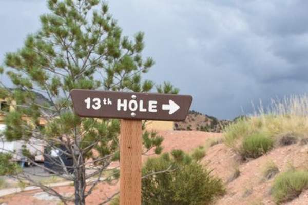
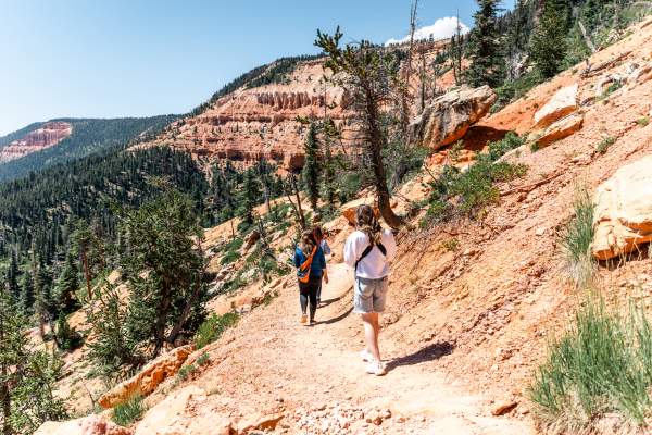
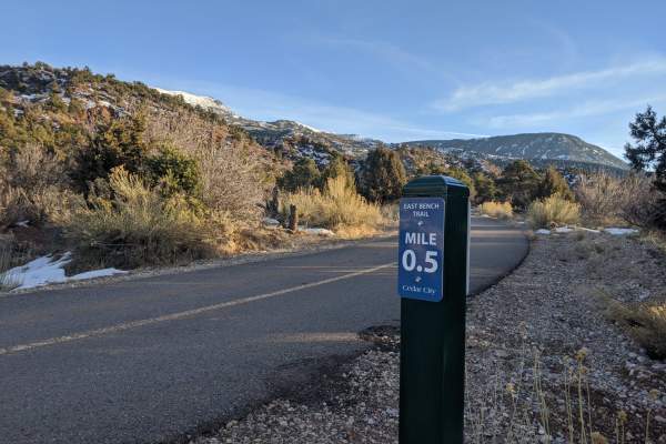
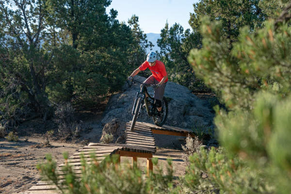
CEDAR CITY, UT - Located near the 13th Hole of the Cedar City Golf Course in the Thunderbird Gardens Trail System, this trail is a multi-use trail for mountain biking, hiking, and trail running. The trailhead has a kiosk, bathroom, water, and paved parking area. The trail has…
CEDAR BREAKS NATIONAL MONUMENT, UT - A picturesque walking trail, located in Cedar Breaks National Monument, leads to a surreal alpine pond. Perfect in the summer to view wildlife and wildflowers. Early in the season this trail may have drifts of snow or be muddy. This loop trail…
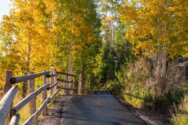
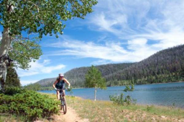
DIXIE NATIONAL FOREST, UT - This out-and-back/loop is short but scenic and ends at Aspen Mirror Lake within the Dixie National Forest. Surrounded by Aspens, it is a spectacular fall destination and is a great hike for families through the summer and fall. Aspen Mirror Lake is a…
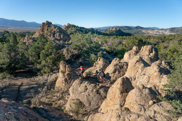
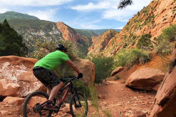
THREE PEAKS RECREATION AREA, UT - The Big Hole Loop is a unique, intermediate ride that takes you by the old iron ore mines. The route has about 500 feet of climbing and gives the rider a bit of a thrill riding on the edge of an iron mine pit. It is worth a ride to at least check…
BRIAN HEAD, UT - The trail follows power-line and ridge spine through a mixed conifer stand, then drops sharply, eventually entering a stand of Bristlecone pine and red ridge looking into Cedar Breaks National Monument and Ashdown Gorge Wilderness Area. View includes a…
BRIAN HEAD, UT - This paved trail follows Hwy 143 through the forest and wildflower meadows of Brian Head. There are several access points in Town, but the trailheads exist at the intersection of Aspen Drive and 143 as well as Bear Flat Road. This trail is also popular with…
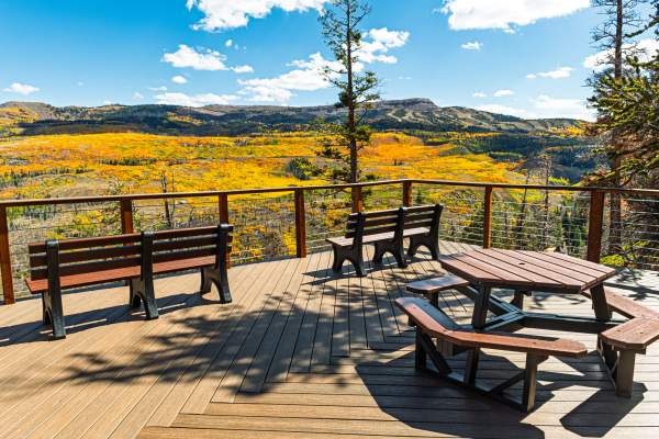
DIXIE NATIONAL FOREST, UT - It is an easy trail that is great for families from late spring to fall. Enjoy views of Zion National Park from an observation deck as you wander among a grove of ancient Bristlecone Pines. Trailhead location: At the top of Cedar Canyon (Hwy 14)…
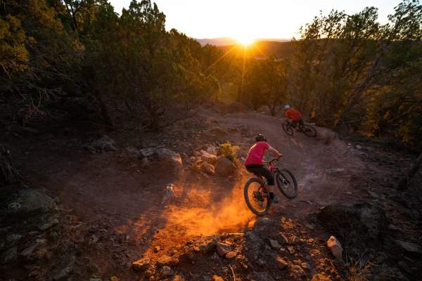
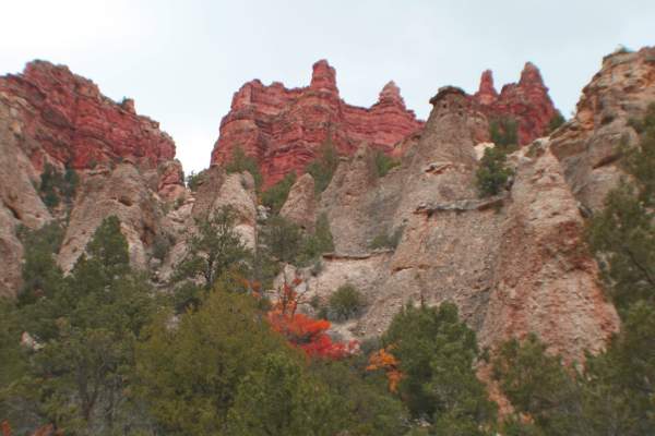
CEDAR CITY, UT - Steep grade down the face of Cedar Mountain. Beautiful views of the Cedar City valley. Fall is the best due to the fabulous fall colors. Can be hiked, but primarily used as downhill mountain bike trail. The trailhead is located up Right Hand Canyon Road off Hwy…
DIXIE NATIONAL FOREST, UT - This trail is an out-and-back trail best in the summer and fall that offers spectacular views of Zion National Park and the Markagunt Plateau, ending at cascading falls from an underground lava tube. Portions of the trail are steep and water may be…
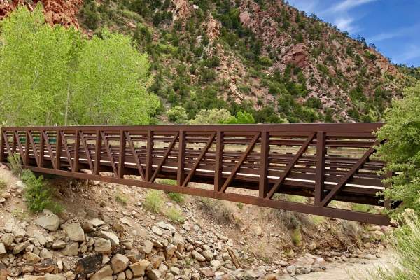
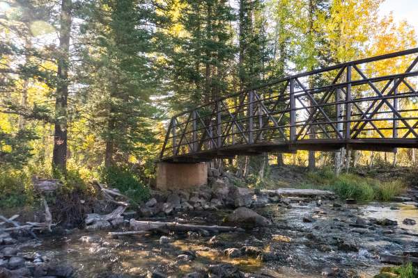
CEDAR CITY, UT - Following Cedar City’s Coal Creek, this gently rolling paved trail leads to a pair of bridges and waterfalls in Cedar Canyon that are surrounded by views of the area’s famous red rocks. The trailhead is located in the Ann J. Gardner Canyon Park at 151…
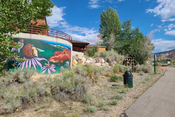
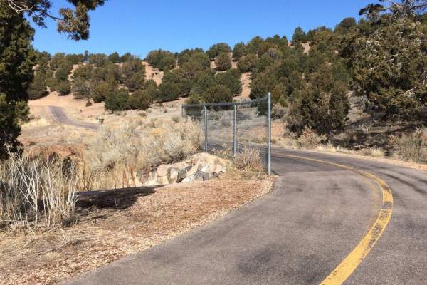
CEDAR CITY, UT - This paved path leads from the East side of Cedar City to the West. Crossing under both Hwy 14 and Main Street, the trail follows Coal Creek from the Ann J. Gardner Canyon Park to Bicentennial Park. Along the way, you’ll pass the Veterans Memorial…
BRIAN HEAD, UT - Our easiest single-track option. This mellow trail takes the scenic route down the mountain, with beginner flow sections and beginner-level single track. All jumps are rollable and easily bypassed. Use to find the Peak Access backcountry exit point to Bunker…
CEDAR CITY, UT - Nestled at the base of a canyon on the south end of town, this trail meanders among Juniper and Pinion Pine and is a perfect stroll after a bite to eat from the numerous local restaurants close by. The trailhead is located on Cross Hollow Road near the…
CEDAR CITY, UT - This paved path leads from the center of Cedar City to the south end of town. Located at the base of Cedar Mountain, the trail leads through the foothills and then through sleepy neighborhoods to Old Hwy 91. The trail also passes the bottom end of the C-Trail. Be…
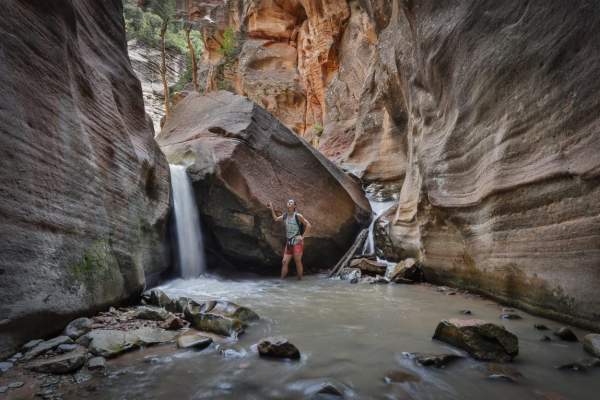
KANARRAVILLE, UT - A moderate to strenuous water hike that requires you to hike along and through the stream up the canyon. Due to the uneven terrain, hiking poles and good grippy water shoes are recommended. Dogs are not allowed. Click HERE for Trail Video Click HERE for…
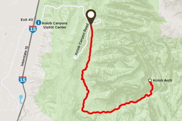
KOLOB CANYONS | ZION NATIONAL PARK, UT - The La Verkin Creek Trail to the Kolob Arch allows hikers outstanding opportunities for solitude in a primitive area of Zion Wilderness. The trail begins at Lee Pass with stunning views of the Kolob Canyons as it crosses Timber Creek and…
CEDAR CITY, UT - Lava Flow is a hike and bike downhill-only trail. This downhill single track includes tabletop jumps and high berms for fast riding. Restrooms are located at the trailhead. This is a dog-friendly trail; a leash is required.
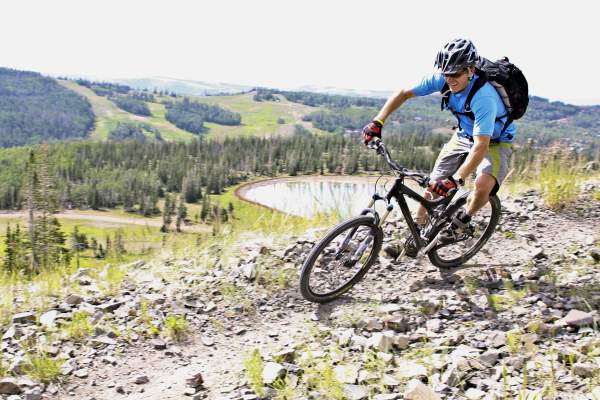
BRIAN HEAD, UT - Ascending to the rim of the Markagunt Plateau, you are treated with some bumpy, heart-pounding descents that will bring you to a double-track road. You will cross over the road from here, picking the single track back up in a forested meadow. You will see signs…
CEDAR CITY, UT - Easy trail that meanders its way up the hill. Turn around once you have reached the Upper Lava Flow trail. Please be aware this is a popular trail among mountain bikers; use caution around corners. Trailhead location: South end of Cedar City, the Southview…
BRIAN HEAD, UT - This blue line contains berms, jumps, tables, and beginner step-ups. All features are rollable with no mandatory jumps or drops. Use this connector trail to find the trailhead for Wildflower and connect with Lil' Gritty, Z-Line Connector, Lower Glitter…
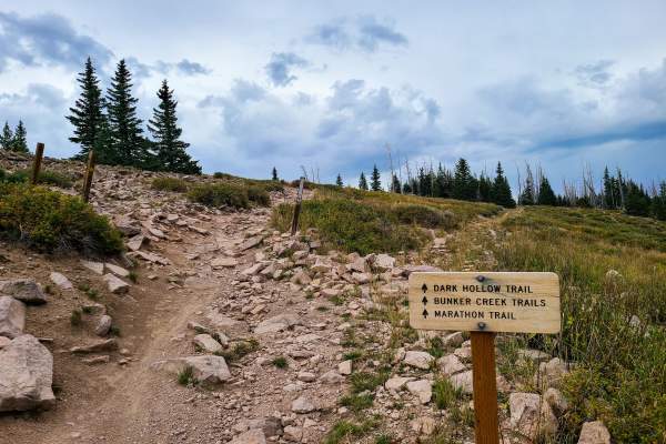
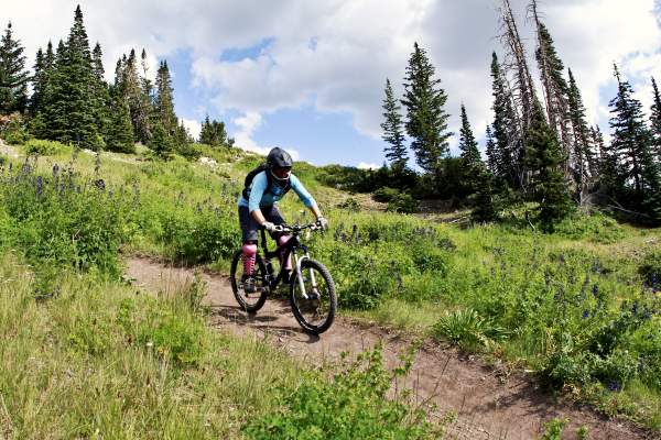
BRIAN HEAD, UT - The trail combines ridge line single track with a downhill ride through changing forest clusters amongst wildflower meadows and ponds. Follow the Sidney Peaks Trail to the intersection with Dark Hollow and turn right on the Lowder Ponds trail (also the Marathon…
BRIAN HEAD, UT - Enjoy this 2.1-mile out-and-back trail near Brian Head, Utah. Generally considered an easy route, however, with exposed sections including steep drop-offs and slippery conditions when wet, use caution. Trailhead location: From Hwy 143 at the North end of…
BRIAN HEAD, UT - This trail splits off early from the Color Country trail. After crossing UT Hwy 143, you will enjoy open meadows before ascending through the forest overlooking Ashdown Gorge and Cedar Breaks National Monument behind Lightning Point Mountain. Drop into the Upper…
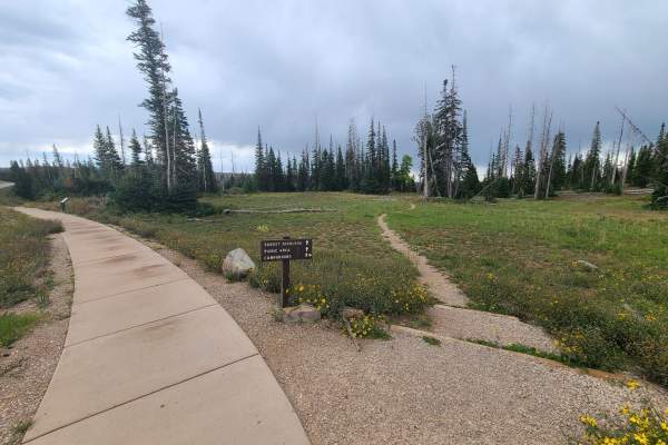
CEDAR BREAKS NATIONAL MONUMENT, UT - This trail is unpaved and connects the Point Supreme Campground with the Sunset Trail near Point Supreme. This path is great for birdwatching and wildlife viewing. It is also a great way to get away from crowds.
DIXIE NATIONAL FOREST, UT - A moderate 8.6 mile loop around the beautiful Navajo Lake near Duck Creek Village. The trail is primarily used for hiking, camping, and mountain biking. There are two official trailheads, one located at the east end of Navajo Lake the other on the…
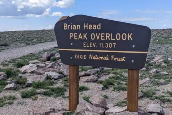
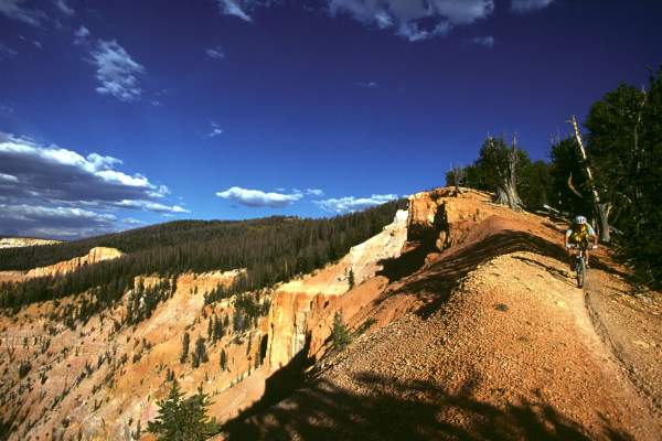
BRIAN HEAD, UT - The Navajo Point Loop receives an advanced rating because you ascend 600 vertical feet on a dirt road, over the course of one mile. The remaining portion of the trail is intermediate. Offering one of the most scenic overlooks in the area, the climb is worth it…
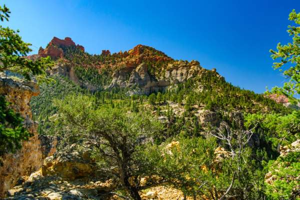
DIXIE NATIONAL FOREST, UT - This trail is a steep and steady climb that rewards hikers with a spectacular view of the Vermillion Castle, other canyon rock formations, and surrounding hills. Hiking poles are recommended due to areas of loose gravel. This is a pet-friendly trail…
CEDAR CITY, UT - Enjoy a stroll on a paved path that loops around the fields between the Iron County School District Office and Cedar Middle School. Particularly good at sunset, the loop offers views of Cedar Mountain and the south side of Cedar City. Trailhead location…
THREE PEAKS RECREATION AREA, UT - The practice loop and skill loop offer riders a chance to hone their skills and experience challenging obstacles scattered through the trail system. Easy and smooth, with some small berms and a couple of optional bridges. This is a good place to…
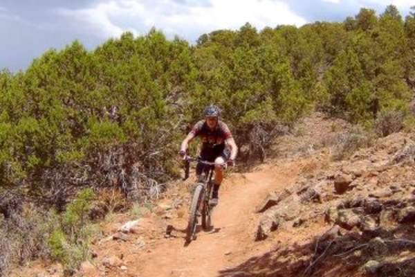
CEDAR CITY, UT - Twisty technical singletrack and ATV track on the edge of Cedar City. The climb in Razorback wash is intermediate in tech requirement, while the bandland "fin" area is expert level. Trailhead location: The recommended starting points are the ATV…
CEDAR CITY, UT - A multi-use trail located in the Thunderbird Canyons Trail system. The trail is nestled in the Red Hill east of Cedar City. Follow the trail until it intersects with the Thor's Hideout Trail and Thor's Lookout. From the intersection, you can either turn…
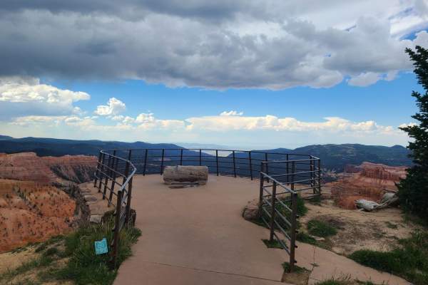
CEDAR BREAKS NATIONAL MONUMENT, UT - The South Rim Trail offers spectacular views in all directions. The Spectra Point Viewpoint is located at the one-mile mark, the Ramparts Viewpoint is located at the two-mile mark, and The Bartzen Viewpoint is located at the 2.5-mile mark. The…
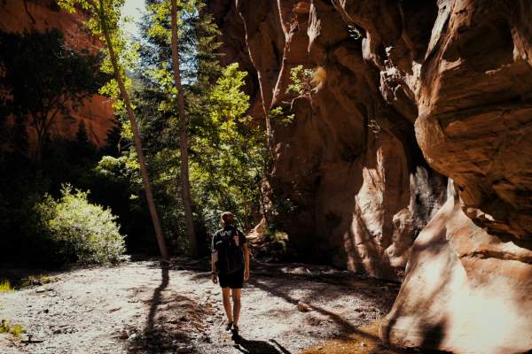
KANARRAVILLE, UT - A beginner slot canyon that follows an old jeep trail through meadows into a narrow canyon. Turn around as the trail becomes difficult to pass without equipment. This trail is pet-friendly; leashes are required. Click HERE for Trail Video Trailhead…
CEDAR BREAKS NATIONAL MONUMENT, UT - This accessible paved trail runs between the Point Supreme Overlook and Sunset View Overlook. The park picnic area is located at the halfway point of this trail near the campground. Built to offer all ages and abilities the opportunity to…
KOLOB CANYONS | ZION NATIONAL PARK, UT - The trail follows the middle fork of Taylor Creek in Kolob Canyons, winding past two homestead cabins and ending at the Double Arch Alcove. The trail does cross the creek at several points. The trail is accessible year-round if the scenic…
CEDAR CITY, UT - Some steep climbs and switchbacks through fabulous red-rock country to a stunning view of Cedar City and unique rock outcroppings. This trail is dog-friendly and also popular with mountain bikers. Trailhead location: Thunderbird Gardens on 900 N (behind Cedar…
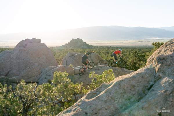
THREE PEAK RECREATION AREA, UT - The Three Peaks Loop is a classic route near Cedar City in the Three Peaks Recreation Area. To access the loop you need to pedal a couple of miles from the mountain bike trailhead to reach the loop. The route is appropriate for…
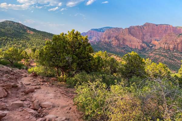
KOLOB CANYONS | ZION NATIONAL PARK, UT - Perfect for an afternoon walk, the trail follows the ridge to a small peak, offering views of Timber Creek, Kolob Terrace, and Pine Valley Mountains. The trail is accessible year-round if the scenic drive is open. Trailhead location: At…
CEDAR CITY, UT - A hillside trail on the south end of Cedar City. The trail has both minor climbs and descents passing through the foothills. Portions of the trail are exposed to the sun later in the morning and throughout the day. The trail can make a good loop ride to connect…
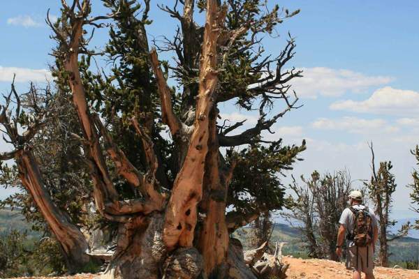
DIXIE NATIONAL FOREST, UT - Featuring a labyrinth of Bristlecone Pines and a unique view of Cedar Breaks, this is a high-elevation hike with a sheer drop-off at the end. From the trailhead, there is a brief downhill followed by a steady climb that is worth it! Trailhead location…

PAROWAN, UT - This hike is very steep. The elevation change is approximately 2,000 feet and can be challenging for less advanced hikers. First named by Hiram Ackley Hendrickson on Valentine's Day, and suggested as a lasting name by Mayor Howard Joseph on February 4, 1959. In…
DIXIE NATIONAL FOREST, UT - The trail is primarily used for hiking, nature trips, and bird watching, and is best used from March until October. Use caution as the trail climbs steeply to a ridge spine and continues to a massive red rock cliff. The trail then crosses a side hill…
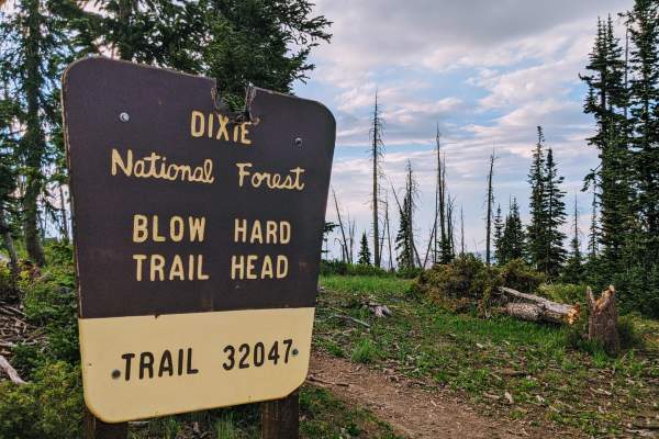
DIXIE NATIONAL FOREST, UT - Hikers can hike a mile or all 32 miles. This hike offers beautiful views of the Virgin River Rim and the northern terrace of Zion National Park. This is a high-altitude trail for hiking, mountain biking, and horseback riding. Trailhead…